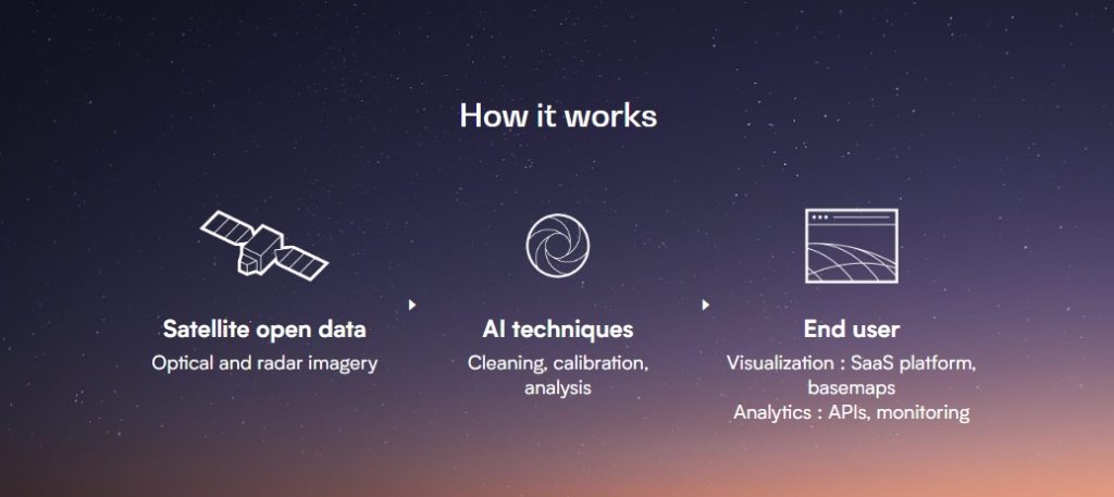
Nimbo: a unique look at the Earth
How our innovations make satellite data access easier than ever.
At last, satellite data made easy
Nimbo is a unique solution revolutionizing access to satellite data : for the first time, geospatial visualizations made available anywhere on Earth, in a continuous fashion, without clouds.
Nimbo’s cutting-edge artificial intelligence models applied to remote sensing bridge the gap between Earth observation’s amazing resources and public or private organizations’ strategic needs.
At last, the full potential of geospatial analytics is unlocked to support their initiatives towards climate resilience and environmental preservation.
The Earth Online platform to explore chronological images of the Earth
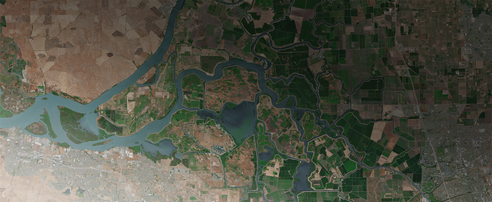
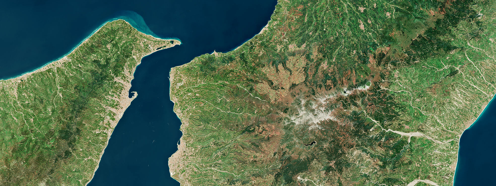
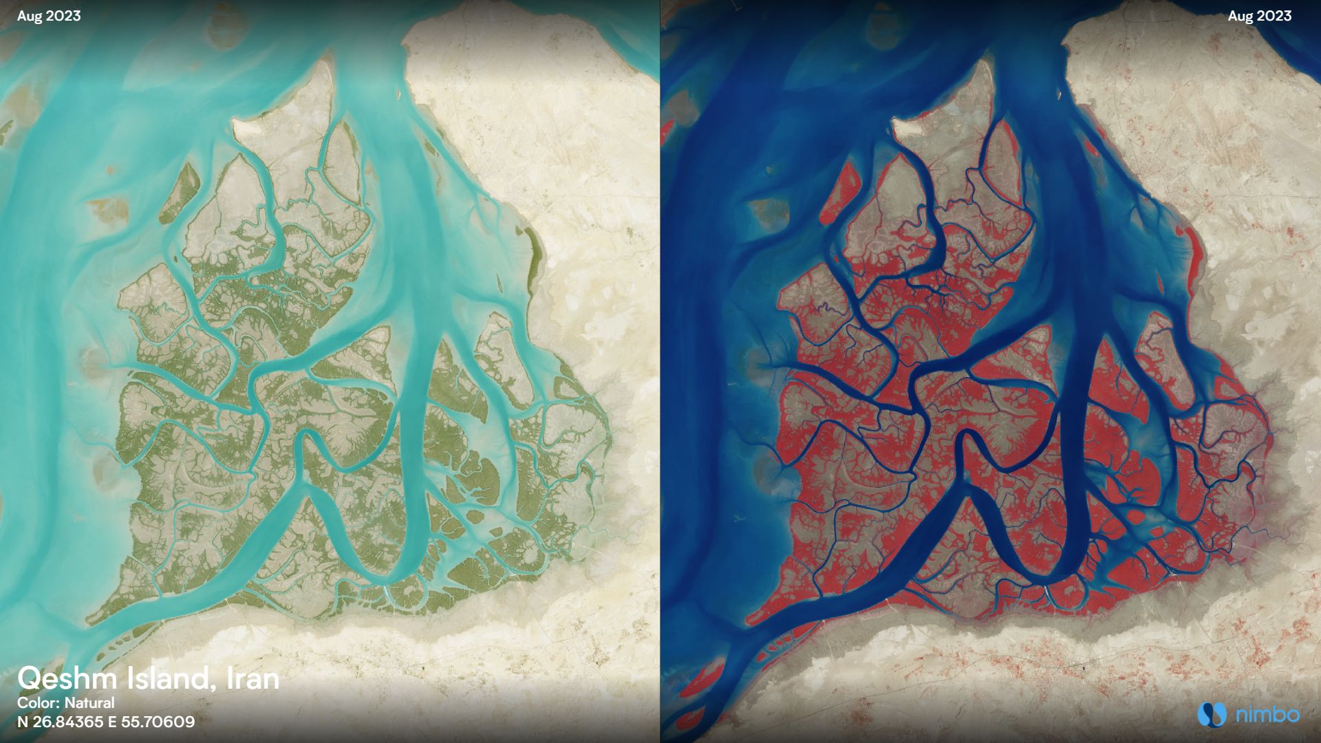
Earth Basemaps, for GIS professionals : seamless, cloud-free images of the planet, updated every month
Live Earth Analytics, using machine learning to extract geospatial analytics from satellite imagery

Continuity

Clarity

Colors

Coverage
High-Resolution satellite images
Nimbo uses open access Earth images available from the European Union’s Copernicus Programme. The data is collected by the Sentinel satellites, a mission launched by the European Space Agency in 2014-2105 to monitor the environment. Nimbo specifically uses radar imaging (Sentinel-1) and high-resolution optical imagery (Sentinel-2).
Cutting-edge artificial intelligence
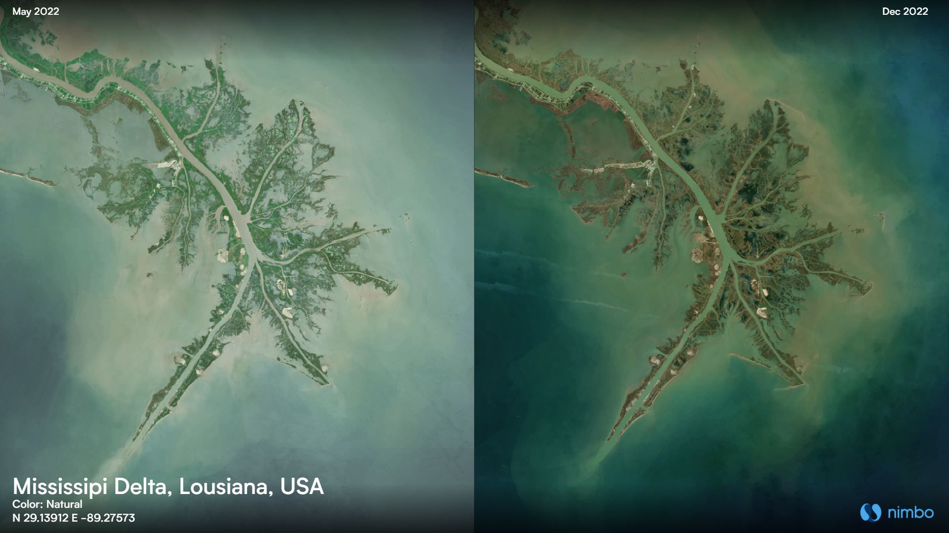
Satellite images are fragmented and frequently blocked by clouds. We have developed innovative AI processes to reconstruct seamless, cloud-free maps from Sentinel imagery, one for every month since 2019, in 5 different color layers.
Beyond Nimbo, artificial intelligence is also key to achieving automated land recognition in record time. Kermap produces such exclusive information on land-use, crop cover, natural or urban spaces. Have a glimpse, for instance, at our 2020 map of dominant crops in Europe

Unique Earth maps

Geospatial innovation

Data sovereignty
Where Nimbo comes from
Breakthrough AI tech by Kermap
In order to produce the satellite maps available on Nimbo, the difficult part is to correctly detect clouds and shadows on Sentinel satellite images so as to produce monthly syntheses of the highest quality.
Another is to produce data that is the most homogenous possible to facilitate image processing up to a continental or global scale. Nimbo’s 8-bit basemaps have taken up the challenge, with vibrant and consistent images across the entire globe and in all types of landscape contexts.
Kermap’s team has achieved this by developing our own processing chains based on a probabilistic approach (neural networks). The model has delivered outstanding performance, bringing seamless, homogenous images of the Earth on to the Nimbo platform. And this is not the end of it, as we continue to tune its model to deliver ever clearer graphics and improved resolution, while providing new maps every month.
Expert, agile, reliable
As a French start-up with a few years of existence, we at Kermap are incredibly proud to bring out Nimbo. Both Earth observation platform and professional application, this solution embodies what has been our driving force since the beginning : facilitating access to spatial imagery for a non-specialist audience.
Nimbo is proof of how our artificial intelligence models applied to remote sensing can help businesses and local authorities meet their planning and environmental challenges. Expertise, innovation, reliability and agility: private and public actors can count on KERMAP’s core values and wide range of products and services to inform their decision-making and actions.
KERMAP was created in 2017 and is based in the tech-intensive area of Rennes, Brittany, where we operate with 20 staff and counting. Learn more on kermap.com