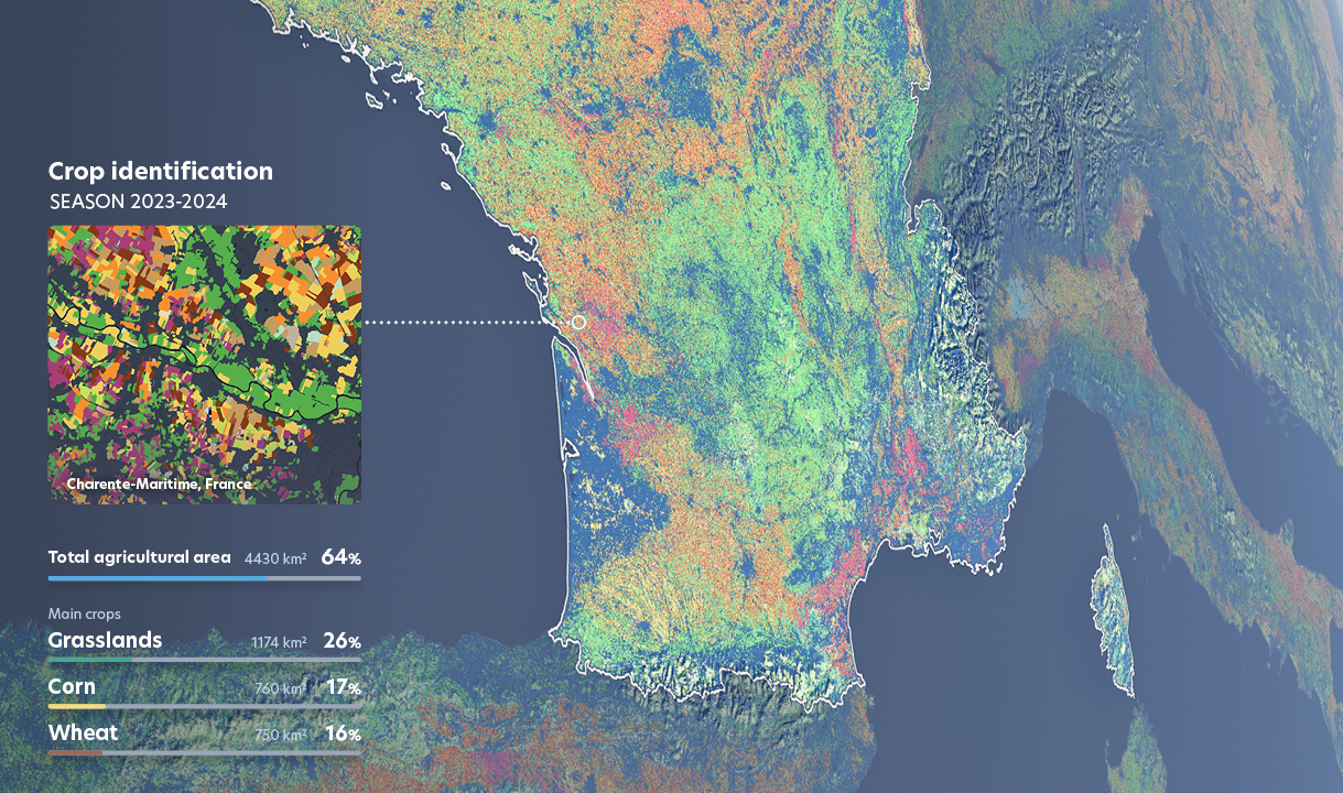
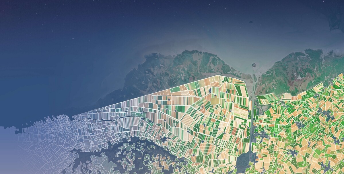
CROP IDENTIFICATION
Know what’s growing where
Stay aheahd of the game with Nimbo’s crop identification data available as early as season end, at any scale. Access large-scale agriculture insights or focus on specific areas and parcels to monitor crop history and rotation.
ENVIRONMENTAL PERFORMANCE & CSR
Measure, report, verify
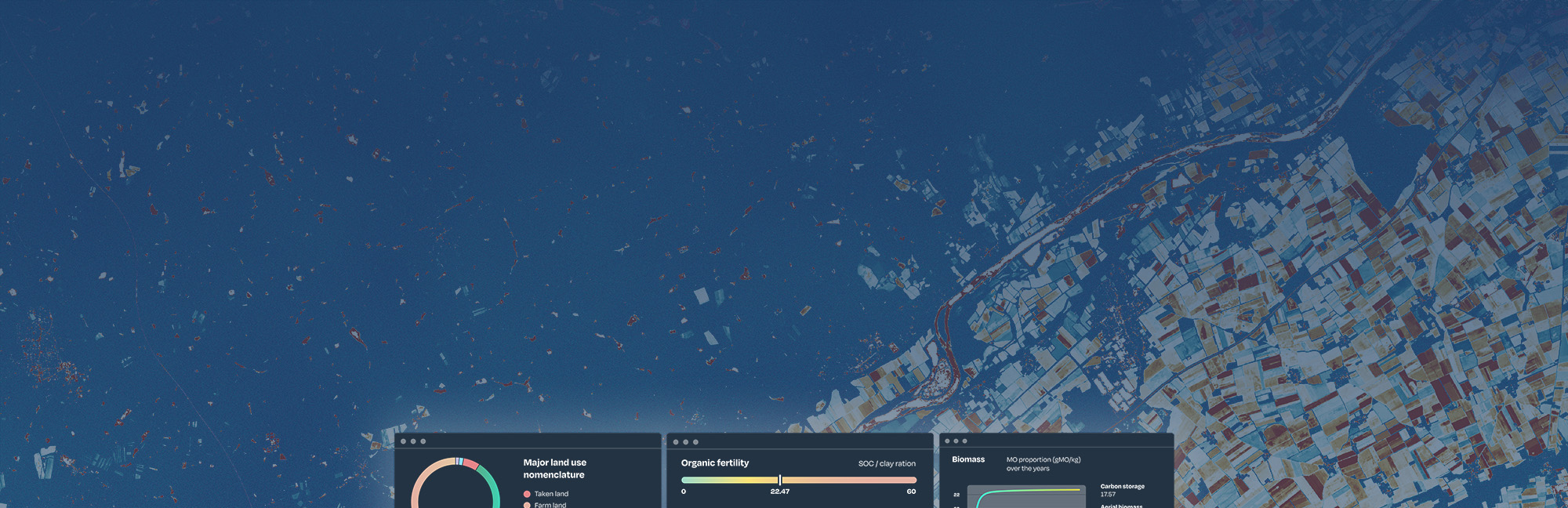
Nimbo provides public and private organizations with non-stop, objective geospatial analytics to monitor sustainability initiatives, such as regenerative agriculture.
User-friendly indicators available through reports, dashboards or API integration to verify implementation and measure efficiency.
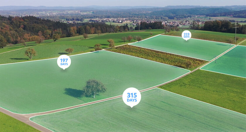
Satellite data for regenerative agriculture monitoring
Find out how Nimbo supports regenerative agriculture initiatives (Nestlé, Saint Louis Sucre, Vivescia Group…) to help stakeholders and farmers monitor the implementation of sustainable agriculture practices.
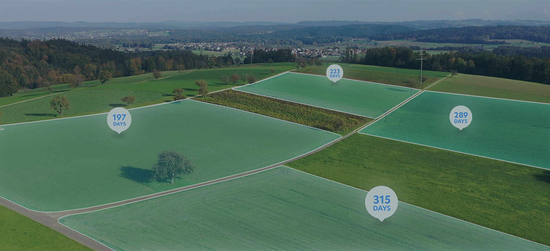
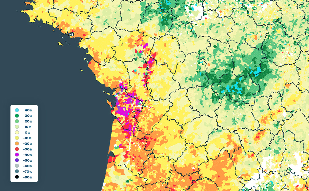
WATER
Get near real-time insights on our most precious resource
Nimbo’s continuous stream of satellite data helps communities around the world in their efforts to sustainably manage water resources.
Actionable analytics and early warning systems for environmental conservation, irrigation monitoring and drought resilience.
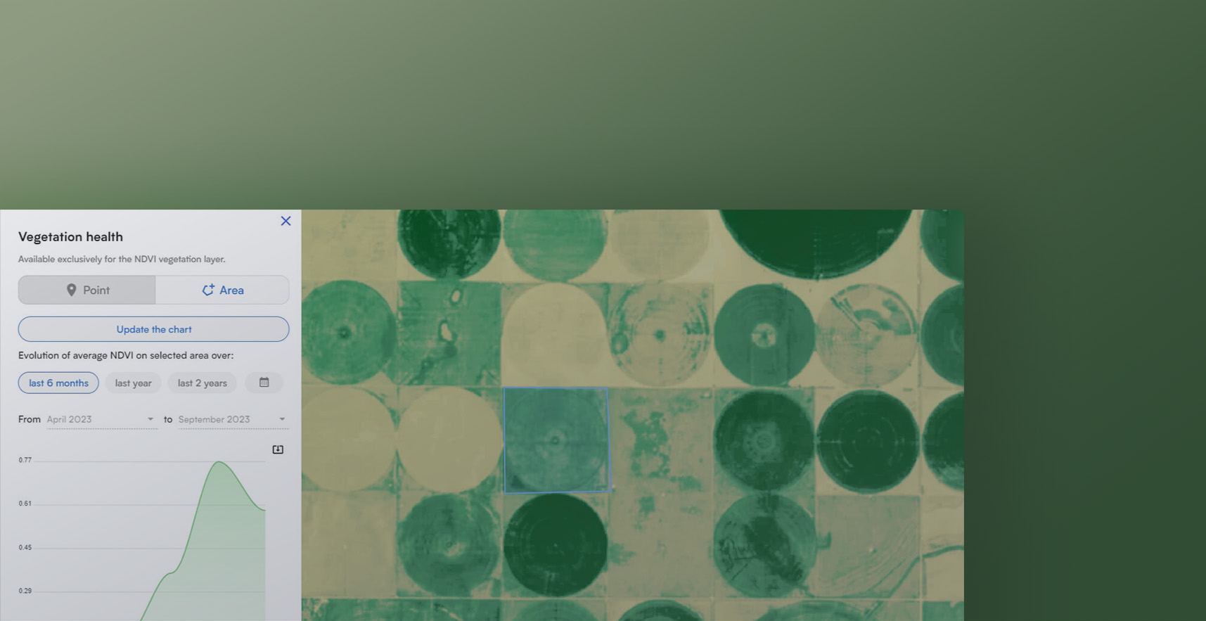
Earth analytics: non-stop NDVI monitoring
Use Nimbo Earth Online’s free NDVI monitoring feature to assess vegetation health, anywhere in the world.
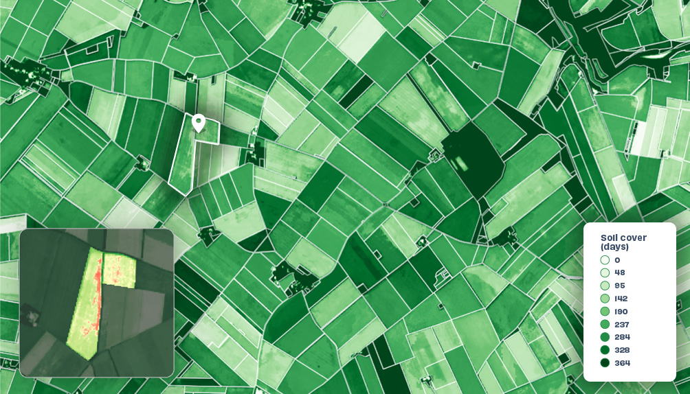
GRASSLAND
Quantify climate impacts
Real-time assessment of climate hazards impact, at any scale.
Dynamic forage production indices to inform public and private compensation schemes like parametric insurance.
Tell us about your project
Get in touch with us to find out how NIMBO analytics can improve your company’s access to key remote sensing data through satellite imagery