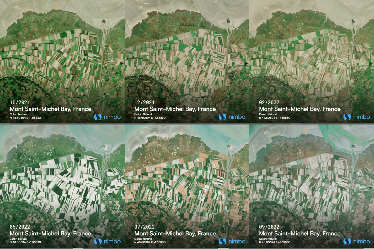
Satellite timelapse of Mont Saint-Michel Bay
Crop rotation around a world-renowned site
Here’s a 12-month crop timelapse over one of the world’s most famous monuments and its bay. Upper right is the Mont Saint-Michel, notice the distinctive feature showing in its moving shadow ?
Running straight south of the Mount is the Couesnon river, loosely marking the limit between Brittany – our home region by the way – and Normandy. Sitting right at the mouth of the river, the Unesco World Heritage site (so is the whole bay) supposedly switched regions as the Couesnon river changed its course throughout centuries. As the story goes, “Le Mont” ultimately landed in Normandy (there are more robust historic arguments though). Hence the Breton tongue-in-cheek saying that “the Couesnon, in its folly, has put the Mount in Normandy”.
Restoring the Mont Saint-Michel to insularity
On a more serious note, the real controversy about the Mont today lies in the efforts to restore its island character. Over the centuries, the surrounding bay had silted up, leading to a gradual loss of the site’s insularity, and turning it into more of a rocky hill than a true island. To restore Mont Saint-Michel’s maritime character and address the environmental issues that had arisen due to this siltation, a major restoration project was undertaken from 1995 to 2015.
Titanic works, mixed results
Works included extensive dredging of the bay and hydraulic engineering to control the flow of water and sediment, construction of an elevated causeway to improve water circulation below, relocation of car parking lots… However, critics point out that these efforts have just helped regain Mont-Saint Michel’s insularity for a few days every year. Meanwhile, sediment accumulation has been diverted to other parts of the bay, causing rapid transformation of their ecosystems, while brackish waters have started to dent into nearby farmland.
Nimbo Earth Online with modified Copernicus Sentinel data (2021-2022)
