Iceland: Grindavik volcano eruption
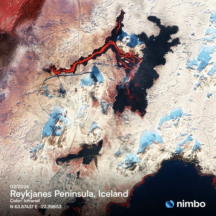
Satellite image of volcano eruption, Iceland
The Reyjkanes Peninsula in Southwestern Iceland has experienced a succession of volcanic eruptions and earthquakes in late 2023 and early 2024. The main stream of lava is clearly visible on this satellite view from Nimbo’s infrared layer in February 2024. But the dangerous flow of molten rock also ran beneath the ground, where it came out through fissures before cooling into a distinct mound. This one is visible on the satellite view south of the main stage of the eruption.
Volcano threat on Grindavik
Smaller fissures also opened near Grindavik, where lava engulfed some houses. A tiny dark shaped of cooled lava can indeed be seen having encroached at the northern limit of the town (bottom of the picture). The coastal town, home to 4,000, has been evacuated on suspicion that more lava could surface inside. Up until now the defensive barriers erected have managed keeping most of the lava at bay. The question now is whether Grindavik’s inhabitants will ever be able to return to their homes given the dangerosity of the area.
Nimbo Earth Online, contains modified Copernicus Sentinel data (2024)
