Comparing before and after satellite images can be a valuable tool for a variety of purposes, including environmental monitoring, disaster response, land use planning, and more. But this often requires technical knowledge that many do not possess, to manipulate images or select proper dates, especially those that are not obscured by clouds. This can prove hard to achieve for non specialists,
Here’s how Nimbo Earth Online turns satellite comparisons into a child’s play.
Simple before and after satellite comparison : Nimbo’s split feature
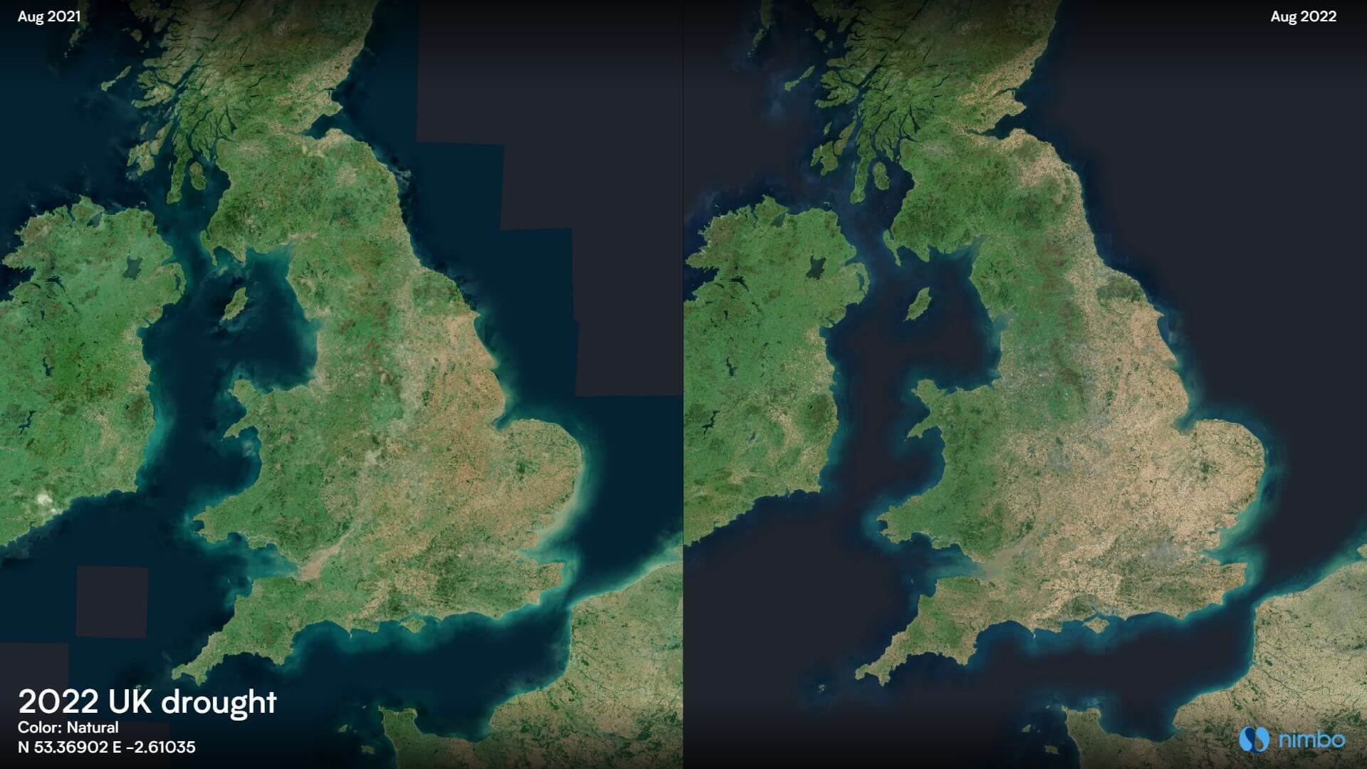
One of the specificities of Nimbo Earth Online is that it lets you explore satellite images over time. Monthly views are available from October 2019 to present. In order to make comparison between two months ultra-easy, our platform lets you juxtapose images in just one click of the “Split” button ![]() .
.
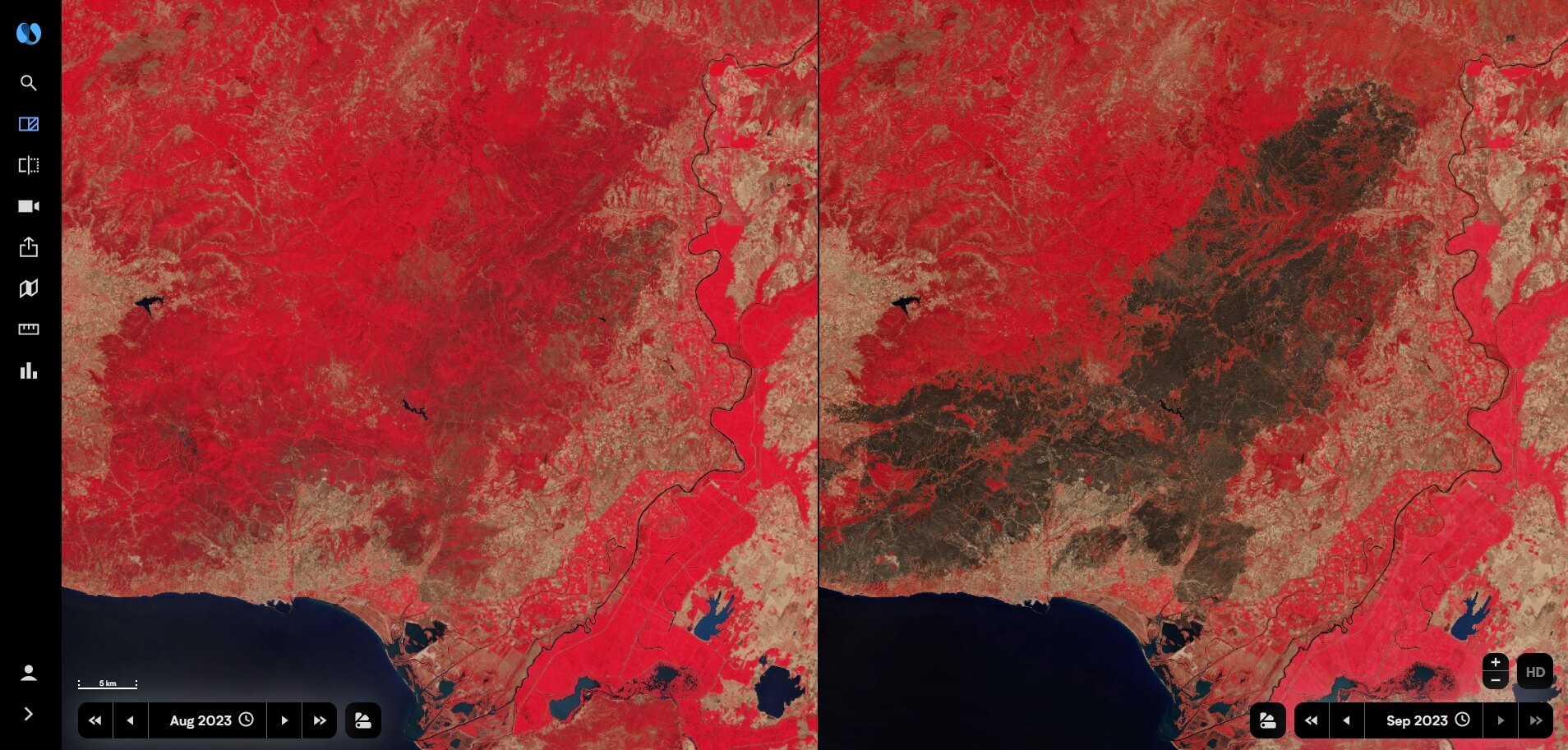
All you have to do then is use the time selectors at the bottom to get to the desired months on each side of the screen. Here’s an example set in Northeastern Greece, scene of the biggest wildfire ever recorded in the European Union, in August 2023 :
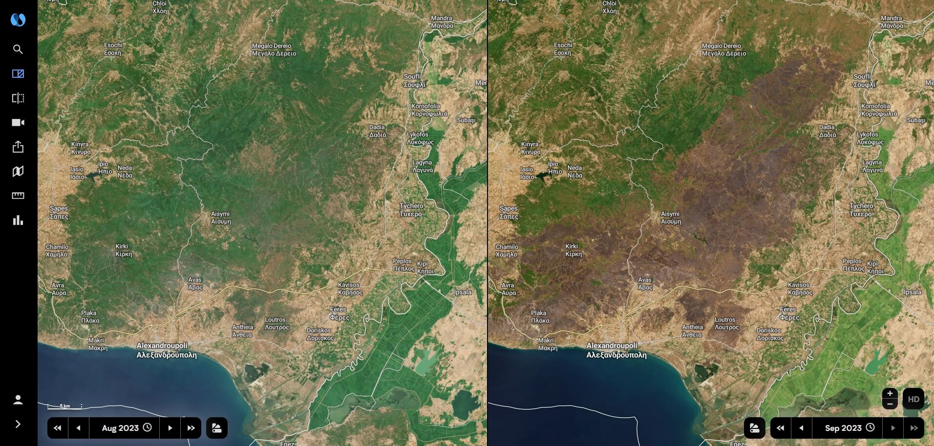
Nimbo’s split features also lets you compare satellite views from our other layers. In the case of a wildfire, for instance, an infrared view will be even clearer when it comes to grasping the extent of the disaster.
Also worthy of note : once you have launched the split feature, you can carry on manipulating one of the maps, to explore another area nearby or zoom in/out, and the other one will automatically adjust.
Unveiling land evolution with Nimbo’s Swipe feature
Another useful and sometimes really striking way to compare before and after satellite visualizations is to swipe one image over the other. That feature is also available on the Nimbo platform under the ![]() icon. An interesting way to compare satellite images from two dates, as dissimilar objects will immediately pop out : a new building, a road under construction, a clear-cut area in a forest, a thinning river…
icon. An interesting way to compare satellite images from two dates, as dissimilar objects will immediately pop out : a new building, a road under construction, a clear-cut area in a forest, a thinning river…
Let’s take a look at this illustration from a foresty area in Willis, Texas, where real estate development has woven some new patterns that can observed from space :
Just as with the Split, the Swipe feature also lets you navigate the map when active, or zoom in and out. Layers can also be changed, as well as the months, using the time selector, while staying on the exact same spot on the map to compare whatever zone you want.
Satellite views before, after, and inbetween : Nimbo’s Timelapse feature
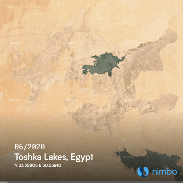
Once you have compared views from space on two different months, it can be tempting to watch how things have transformed over time. Nimbo’s Timelapse feature does just that, in the most easy way. Once you have selected your spot, all you have to do is select a period, or a starting and ending date, how fast you want your animation to roll, and enter the name of the place if you want.
Let’s see what the result is on a satellite animation over the Toshka Lakes, in Egypt :
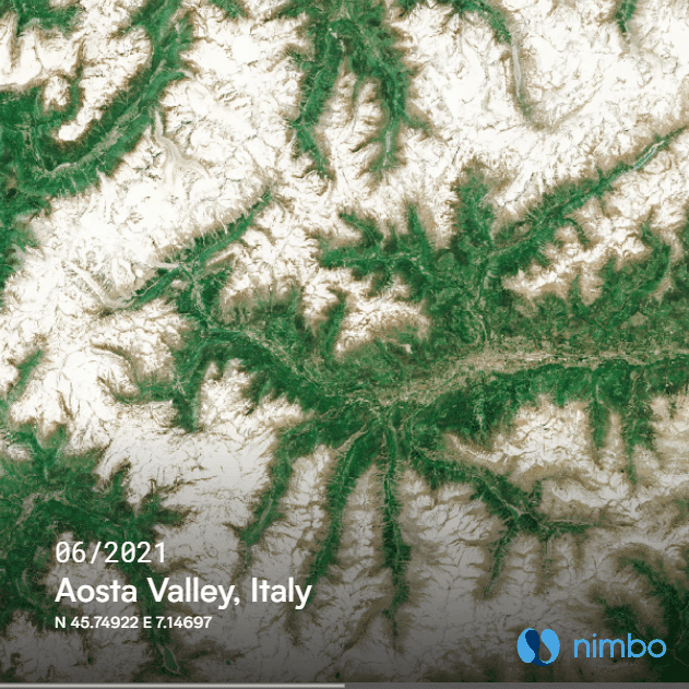
Not interested in the transformation process, just in the before/after satellite view ? You can also use the timelapse feature’s custom time range to compare images from two separate months. Like here in the Alps, to watch how the snow cover decreased under june 2022’s heat wave in the Aosta Valley, Italy :
Sharing your before and after satellite images
You may want to let other people know about a before/after observation you have found while navigating satellite maps on Nimbo Earth Online. Well, we’ve got a feature for that too ! When using the Split or Swipe modes, just click on the export icon ![]() , load a preview. If the visualization is ok for you, all you have to download the file (.png for Split, .gif for Swipe) and share it elsewhere, or use the link to directly share your findings with Nimbo Earth Online users !
, load a preview. If the visualization is ok for you, all you have to download the file (.png for Split, .gif for Swipe) and share it elsewhere, or use the link to directly share your findings with Nimbo Earth Online users !