Access to up-to-date satellite views is becoming a necessity for professionals in many sectors — from local governments to NGOs and innovative startups. But high costs and complex licensing models have often made this data difficult to access. With its new pricing model, Nimbo ensures easy access to satellite data at last: delivering affordable Earth imagery while maintaining the quality and reliability needed for serious work.
Making satellite imagery accessible and affordable
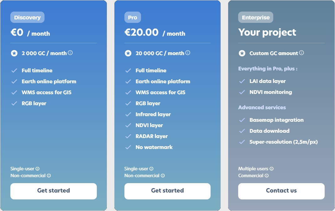
Nimbo’s new plans start at just €20/month (and €10/month for early adopters thanks to our launch offer – discount no longer active). This opens the door for individuals, SMEs, and organizations that previously couldn’t justify the expense of premium satellite data. Combined with the free Discovery plan, which lets anyone access imagery in a limited way at no cost, Nimbo ensures that everyone can now explore and use Earth imagery according to their needs and budget.

What Nimbo brings in: reliable, cloud-free Earth monitoring
Satellite imagery is only useful if it’s clear, current, and easy to use. That’s why Nimbo delivers:
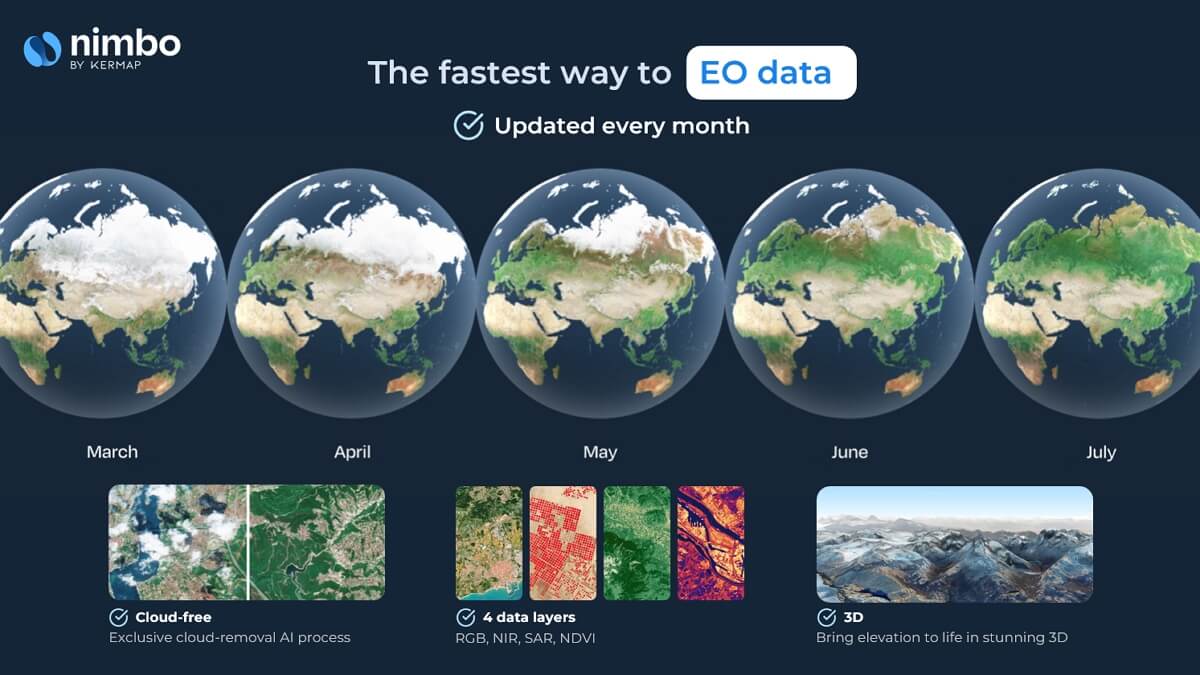
- Cloud-free mosaics, refreshed every month, in 2D and 3D
- Fast display and smooth browsing experience
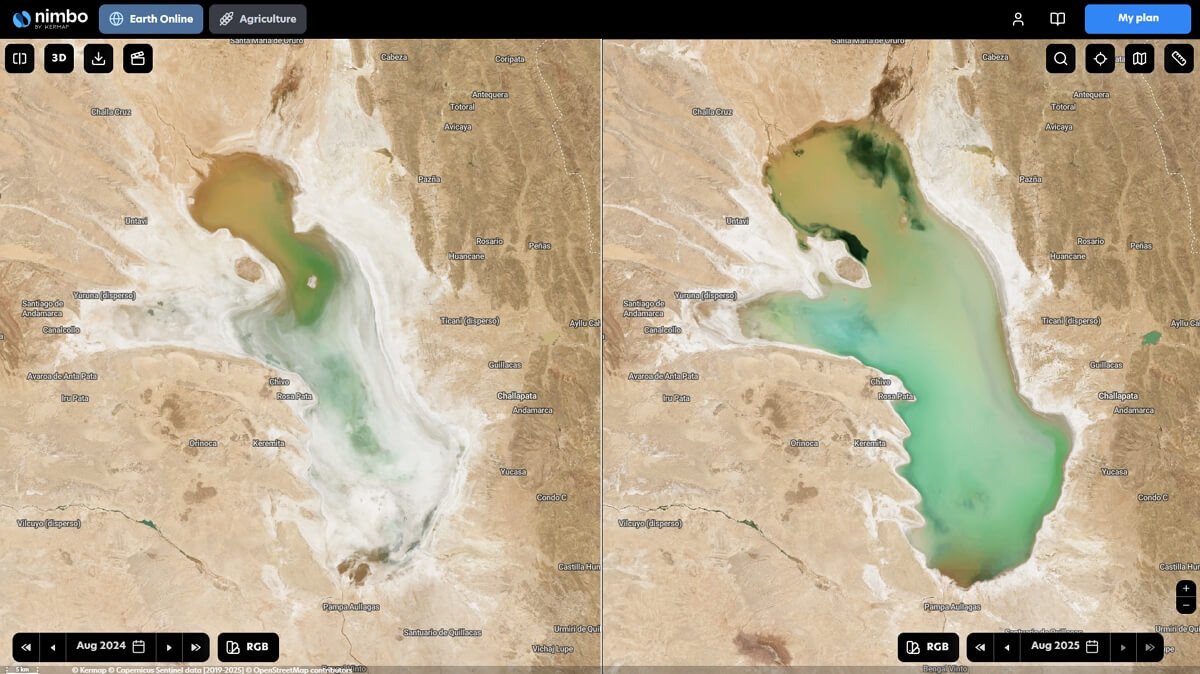
- Simple date selection, making it easy to monitor change over time
- Harmonized colors and seamless mosaics for visual consistency
- User-ready tools like side-by-side comparison and timelapse to track change over time
Plus users get to choose where they will explore Nimbo basemaps: either on the Earth Online platform or directly into their GIS workflows (QGIS, ArcGIS) via WMS/WMTS feeds, using their personal token
These strengths make Earth monitoring faster, more reliable, and more actionable for professionals who depend on accurate data.
Accessible satellite data: save time, focus on what matters
A key benefit of Nimbo mosaics is that they are ready to use: cloud-free, pre-processed, and updated monthly. This means professionals don’t waste time on satellite data anymore. With Nimbo, they don’t need to spend hours cleaning or stitching raw satellite data — they can save time on data preparation and focus directly on analysis, insights, and decision-making, the real value-added tasks.
This efficiency is crucial across many sectors: environmental monitoring for conservation and compensation, water resources, agriculture, especially to measure the efficiency of sustainability programs, urban planning and infrastructure management, and more. Local authorities can track land use, NGOs can monitor environmental impact, and businesses can integrate reliable imagery into new services — all without the burden of heavy preprocessing.
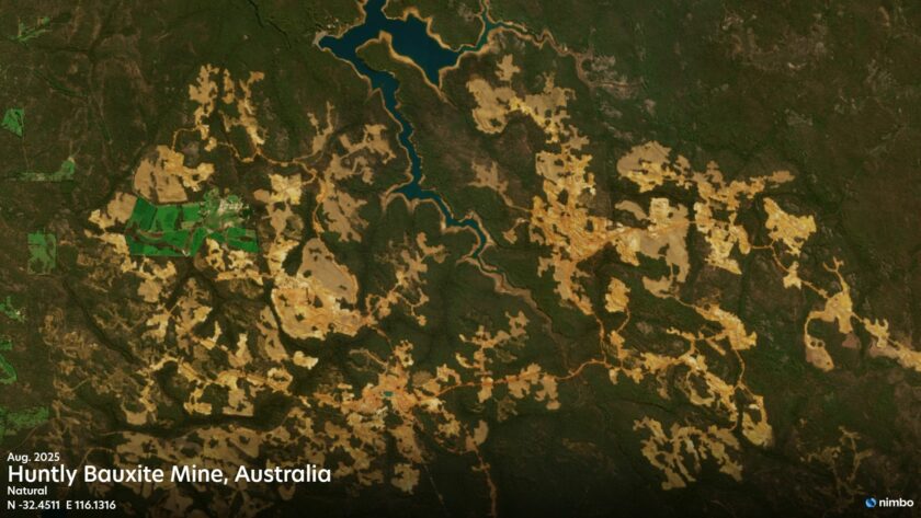
The right satellite data for forest monitoring
One of the most critical applications of satellite imagery is forest monitoring. Healthy forests are vital for regulating the climate, protecting biodiversity, and supporting local communities — but they are also under constant pressure from deforestation, land-use change, and degradation. To track these changes effectively, organizations need frequent, reliable, and cloud-free data that allows them to spot evolutions quickly and take action.
For years, many NGOs, SMEs, and public bodies relied on the NICFI/Planet partnership, which provided free access to high-quality basemaps of tropical forests. With the discontinuation of NICFI’s satellite data program, a major gap has opened for countless actors working on conservation, climate initiatives, and sustainable land management.
Nimbo now stands as the most affordable alternative, offering monthly updated mosaics that are cloud-free and easy to use. By lowering the barrier to access, Nimbo ensures that organizations of all sizes — not just those with large budgets — can continue to monitor forests, report transparently on changes, and make informed decisions in the fight against deforestation.
Balancing temporal and spatial resolution
Monitoring the Earth at very high spatial resolution is extremely costly: commercial imagery providers charge high rates for access, making continuous monitoring unsustainable for most organizations. Yet temporal resolution — the frequency of updates — is just as important as pixel size. Without frequent refreshes, even the sharpest images quickly become outdated.
Nimbo strikes this balance by relying on the best high-temporal resolution data available today: Sentinel imagery from the Copernicus program. Nimbo gathers all Sentinel-2 acquisitions and, through AI-powered image processing, delivers high-quality, cloud-free global composites updated monthly. This ensures professionals always work with the most up-to-date and reliable view of the Earth. And soon, Nimbo will take a step further: introducing a monthly super-resolution product that enhances 10m imagery to 2.5m per pixel, bridging the gap between affordability and detail.
Nimbo: the most affordable way to see Earth clearly
By combining free entry-level access with affordable professional plans, Nimbo is making satellite imagery truly accessible. Cloud-free, updated monthly, and soon enhanced with super-resolution — it’s the simplest and most cost-effective way to keep track of our changing planet.
👉 Discover Nimbo’s new plans and see Earth as you need it — without clouds, and without barriers.