Today, every human activity impacting the Earth must be measured, documented, and verified. From environmental regulations to ESG commitments and international standards, transparency is no longer optional. It is a structural requirement.
The extraction of raw materials sits at the center of this challenge. Mining operations must continuously demonstrate compliance with frameworks like JORC, NI 43-101, and GISTM, while providing proof of land rehabilitation and water management over time.
Nimbo bridges this gap via the Nimbo Earth Observation Platform, providing the objective visual evidence needed to verify compliance and validate responsible resource management. By delivering consistent, analysis-ready imagery, we bring two core advantages to mining workflows:
- 2.5m high-resolution imagery: integrates directly into GIS tools as analysis-ready data, removing the need for manual preprocessing.
- Monthly cloud-free imagery: continuous imagery delivered monthly. This ensures reliable monitoring of extraction and reclamation progress, even in cloud-prone tropical regions.
High-resolution insight: precision identification of environmental controls
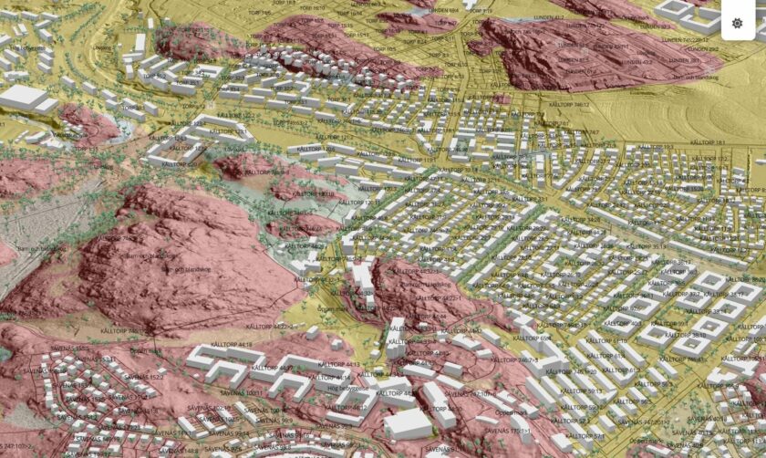
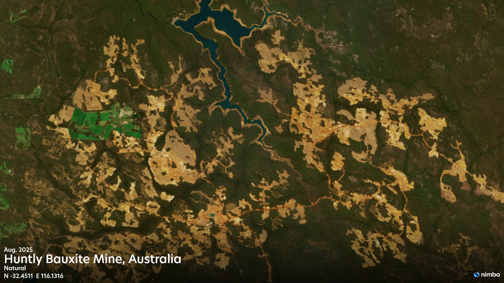
The difference in clarity is immediate when looking at sites like Huntly Bauxite Mine. Where standard 10m imagery leaves feature boundaries ambiguous, Nimbo’s 2.5m high-resolution data brings critical infrastructure and environmental controls into sharp focus. This precision enables the clear identification of sediment ponds, buffer zones, and haul road networks that would otherwise be a blur in raw satellite imagery.
Delivering this data as analysis-ready provides more than just visual clarity; it streamlines the entire technical pipeline. By bypassing the time-consuming tasks of data sourcing, cleaning, and preprocessing, GIS teams can skip the manual preparation and shift their focus immediately to high precision analysis.
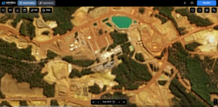
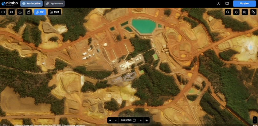
Slide to compare resolution clarity at Huntly Bauxite Mine. Left: Standard 10m imagery. Right: Nimbo 2.5m high resolution.
Tracking progress: the case for monthly continuity
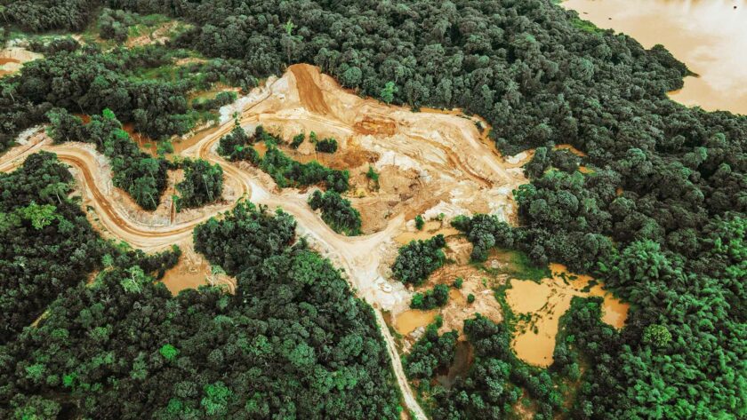
In large-scale operations like the Kaltim Prima Coal (KPC) mine, the landscape shifts rapidly. The slider below demonstrates Nimbo’s ability to capture this evolution by delivering the maximum cloud-free coverage month to month. This is especially critical in persistent tropical regions where clouds often obscure the site for weeks at a time.
Instead of dealing with data fragmentation, environmental teams use these continuous, gap-free mosaics to monitor land clearing and rehabilitation progress. This provides the objective evidence needed to verify that backfilling and revegetation are aligning with the mine plan, securing a reliable audit trail for ESG compliance.
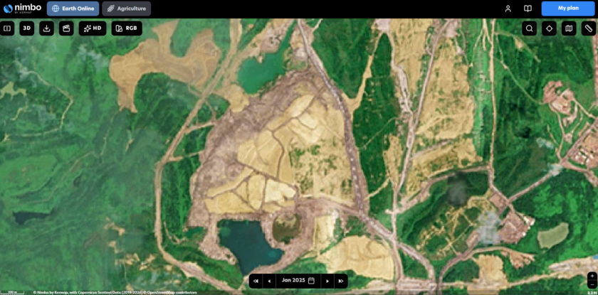
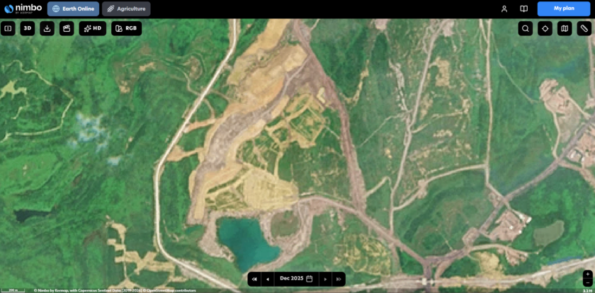
Slide to compare revegetation progress at KPC. Left: Completed earthworks and slope profiling (Jan 2025) / Right: Successful revegetation with dense canopy cover (Dec 2025).
A seamless workflow: instant GIS integration
Accessing satellite imagery should not be a technical burden. Nimbo integrates these basemaps directly into your existing GIS and engineering tools via standard formats like WMTS and TMS. It simplifies complex satellite intelligence into a high-performance utility for responsible resource management.
Technical Resources & Integration To understand how we leverage standardized technologies to deliver an optimal experience, read our article about geospatial formats. For GIS specialists ready to integrate, access our full configuration guides.