Let’s be honest: just because open satellite data, like Copernicus Sentinel imagery, is available doesn’t mean it’s easy to use. Here’s how Nimbo saves the day all the way through your EO processing chain.
If you’ve ever spent hours combing through satellite scenes, only to find them outdated, incomplete, or covered in clouds, you know the frustration. The real bottleneck isn’t access—it’s everything that comes after. From searching and downloading to image preparation and analysis, the satellite imagery workflow is often a time-consuming, highly technical process.
That’s exactly why we created the World maps available in Nimbo: to streamline satellite imagery workflows from end to end and give users instant access to clean, ready-to-use data—no technical headaches required. So let’s take a closer look at how Nimbo helps professionals save valuable time at every step of the journey.
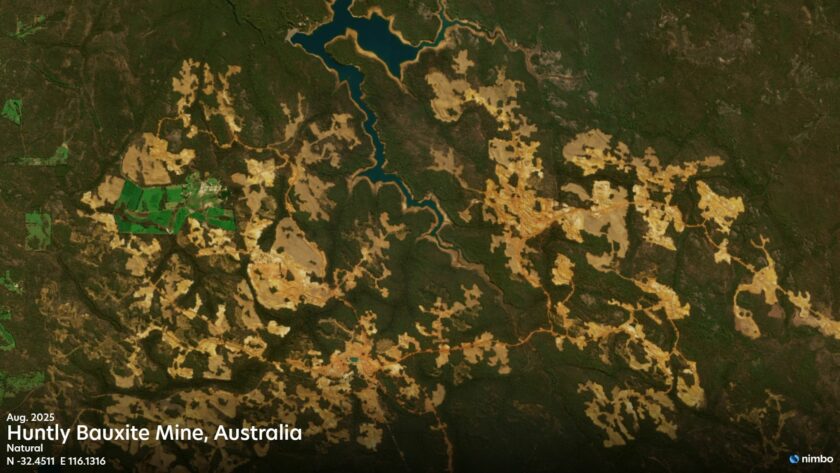
Quick, cloud-free access to the right imagery
When someone asks for a quick update on land or water changes between two dates, you don’t have time to wrestle with filters, file types, or cloud-covered views. You need to know right away whether satellite data shows something useful.
That’s where Nimbo shines. In just a few clicks, you can zero in on your area of interest, adjust the timeline, and instantly explore monthly basemaps. No downloads, no delays—just fast, clean, cloud-free imagery that’s already been processed and is ready to use. It transforms slow, uncertain searches into quick, visual checks that give you the clarity you need in minutes.
Learn more on Nimbo’s satellite basemaps creation process
No more time wasted on satellite imagery downloads
We’ve all been there: you spend time choosing a satellite scene, wait for it to download, and then realize it’s not usable. It’s frustrating and inefficient.
With Nimbo, that problem disappears. The imagery streams instantly—right in your browser or GIS interface. You can explore a region, assess changes, and compare time periods without downloading anything. It’s smoother, faster, and helps you move on to actual analysis without wasting hours managing files.
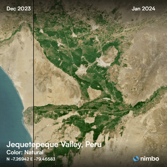
Easily share results with clients and teams
Whether you’re working with a client, manager, or collaborator, not everyone understands raw satellite data. Nimbo helps bridge that gap by making it easy to turn your observations into clear, compelling visuals.
Here on the right is a “swipe” export from the Nimbo Earth Online platform. Completed in two clicks, this kind of illustration is the perfect way to communicate simply on what’s at stake in the area of interest and on the job to be done. It’s a fast way to keep stakeholders in the loop and get approvals or feedback without friction arising from people not being on the same technical page.
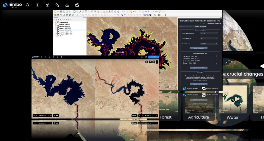
Skip the prep: start analyzing EO data right away
Even after finding the right image, traditional workflows usually require a lot of setup: cloud correction, mosaicking, alignment, and reformatting. For many teams, that prep stage eats up a huge chunk of time before any real work can begin.
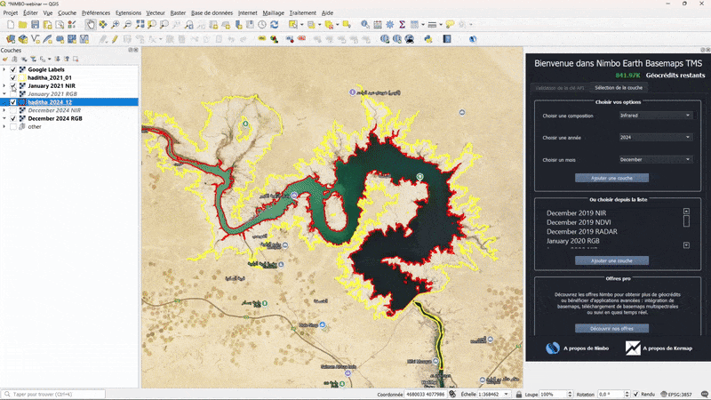
Nimbo takes care of all of that behind the scenes. Every basemap is preprocessed and harmonized, ready to be used straight away. Thanks to its compatibility with GIS tools such as ArcGIS or QGIS (with even a dedicated plugin for the latter), you can bring the imagery directly into your GIS environment, overlay your own data, and get started on your project immediately—without touching a single preprocessing tool.
Replicate your work anywhere in the world
Once a project works well in one region, it often needs to be repeated somewhere else—sometimes halfway across the world. With traditional workflows, that means finding new data sources and going through the same slow process all over again.
With Nimbo’s global basemap coverage, you can apply the same methods anywhere. The data is already standardized, so you don’t have to adjust your workflow. Just pick the new location, and you’re ready to go. It’s ideal for scaling up projects across borders or replicating analysis for clients in different regions.
Less time on processing means more for EO analysis
Nimbo doesn’t just simplify satellite imagery access—it transforms the whole workflow. From quick searches and no-download browsing to instant GIS integration and easy sharing, it’s built to save time at every step.
Whether you’re tracking land use, responding to client requests, or managing environmental data, Nimbo helps you work faster, communicate more clearly, and focus on the insights that matter.
In short, Nimbo is the tool that frees you from the grind of data prep—so you can spend your time on what really counts.
Try Nimbo for yourself to explore all the data and features, or check out the plans that will save you loads of hours on EO data processing !