When access to NICFI’s satellite imagery ended, geospatial monitoring company The Tree Map looked for a new way to visualize and contextualize deforestation alerts on its online platform, Nusantara Atlas. The company produces weekly maps of forest loss across Southeast Asia, complemented by layers on land use, concessions, and protected areas.
To help users verify alerts and explore recent changes, The Tree Map has chosen to stream Nimbo’s monthly cloud-free satellite basemaps — appreciated for their quality, speed of display and affordability.
Finding an alternative to NICFI satellite imagery
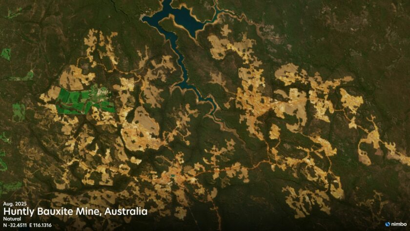
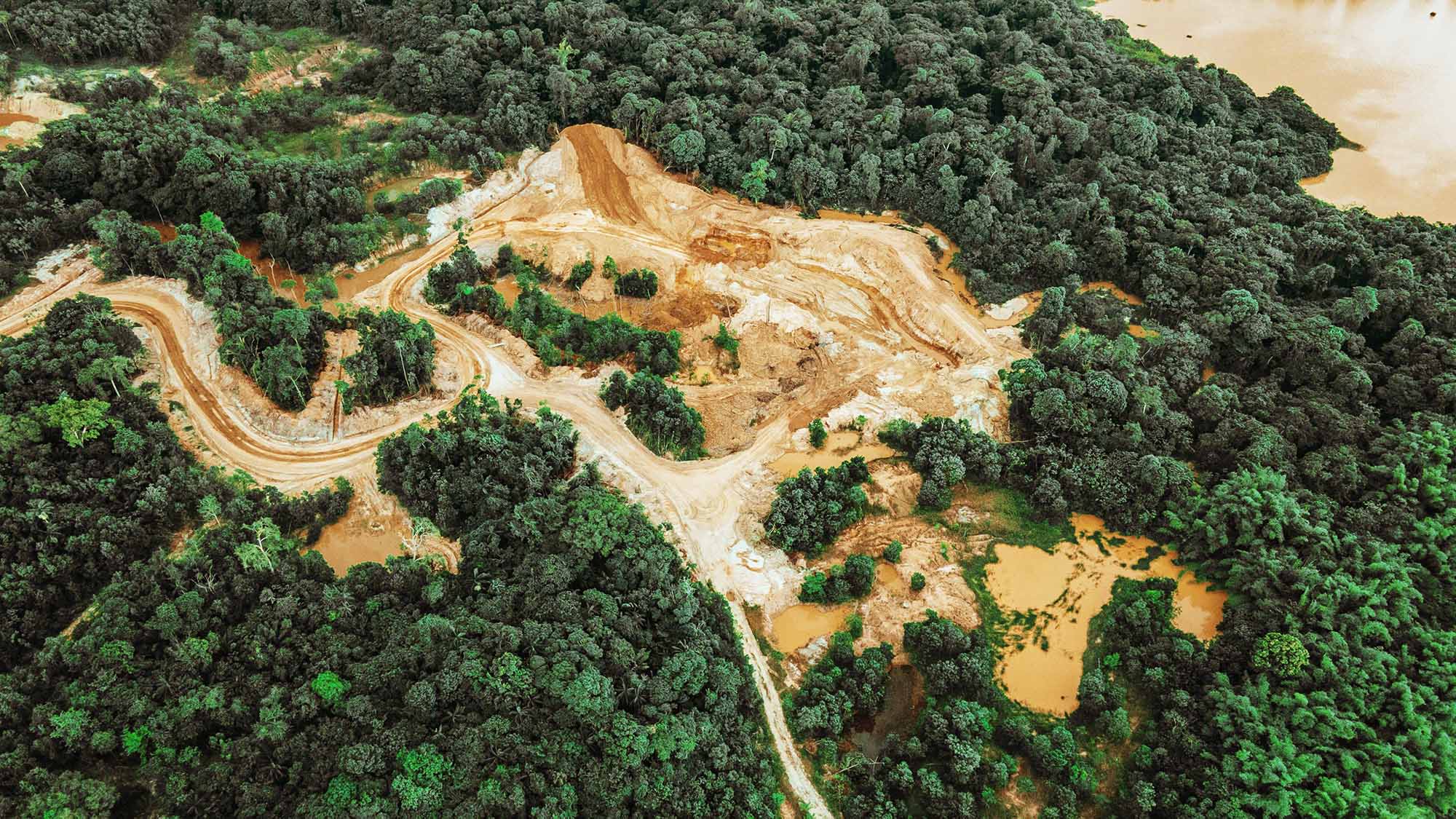
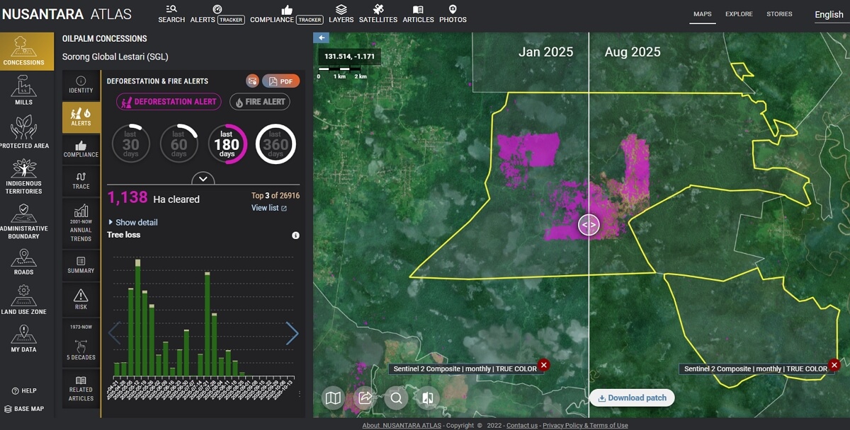
When The Tree Map launched Nusantara Atlas, its open platform for tracking deforestation across Southeast Asia, the goal was clear: make information on forest loss easier to access, understand, and share for all actors involved in forest watch. Every week, the platform ingests new deforestation alerts and overlays them with rich contextual data — from palm oil and pulpwood concessions to protected areas and municipal boundaries — to pinpoint where forests are disappearing and why.
Until recently, to visualize and verify these events, The Tree Map’s team of Earth observation experts, led by founder David Gaveau, relied on imagery from U.S based Planet, distributed through the Norwegian Government’s Climate and Forests Initiative (NICFI) . With the end of the NICFI program, the company needed a new source of satellite imagery that could match the same quality and reliability – without compromising the platform’s fluid experience.
That’s what they have found with Nimbo, now integrated directly into Nusantara Atlas.
Nimbo’s cloud-free satellite mosaics, refreshed monthly and ready to stream, now appear on The Tree Map’s platform as an additional layer that helps users verify alerts and provide visual context for ongoing forest change. The images complement Sentinel-2 and Landsat data, bringing in their ease of access and efficient display to the platform’s monitoring mix.
Adding Nimbo to Nusantara Atlas: a smooth user experience
Behind the scenes, the transition proved remarkably simple. The integration of Nimbo data into the Nusantara Atlas environment went smoothly, David Gaveau says, as the satellite mosaics are accessible through standard TMS and WMS endpoints, allowing The Tree Map team to plug the stream directly into their platform with minimal configuration.
“The key advantage is that Nimbo displays quickly” (David Gaveau, founder, The Tree Map)
This ease of integration mirrors the efficiency and fluidity of display that users experience on Nusantara Atlas — the result of Nimbo’s satellite basemaps being natively optimized for fast streaming and smooth visualization.
“The key advantage,” David Gaveau confirms, “is that Nimbo displays quickly.” In a system where deforestation alerts update every week, performance is key. Users need to open a region, check an alert, and instantly see what has changed – without waiting for heavy imagery to load. Nimbo’s monthly cloud-free basemaps, also called composites, provide just that, with rapid display of an area of interest, anywhere in the world, at the desired periods.
Clear, consistent satellite mosaics to see forest change
Beyond technical integration and performance, The Tree Map team also values the overall quality of the imagery provided through Nimbo.
“We are quite satisfied with Nimbo composites. They are of very good quality, equivalent to the quality of Planet’s material from the NICFI program.” (David Gaveau, founder, The Tree Map)
Updated every month and consistently cloud-free, the mosaics provide clear, homogeneous view of the world, including tropical regions, a reliable visual reference to verify deforestation alerts and understand changes in land use over time.
When satellite imagery makes economic sense
“It’s complicated to build monthly composites,” The Tree Map’s founder continues, noting that access to such data at a competitive price remains rare in the field. For a company of The Tree Map’s scale, high-resolution imagery can be prohibitively expensive. Plus it often comes with restrictions on streaming or redistribution.
By contrast, Nimbo’s basemaps are affordable, easy to integrate, and licenced for commercial use, suited for streaming on platforms like Nusantara Atlas that aim to keep environmental information accessible to all.
Empowering environmental monitoring
Nimbo’s approach — providing high-frequency mosaics optimized for rapid display — offered the right balance between resolution, frequency, and usability. By keeping cost at a reasonable level, the solution proves well suited to a wide range of environmental monitoring needs.
Nimbo’s integration within The Tree Map’s platform shows how it can support diverse environmental monitoring purposes through the same ease of use and open access — from forest dynamics to agriculture, urban planning, and ecosystem management — all with the same commitment to transparency and accessibility.