NIMBO STREAM
Boost your app with fresh satellite imagery
Stream Nimbo’s Earth basemaps directly into your platform or product. Cloud-free, updated every month.


“Integration was effortless, Nimbo Terrain data makes our tool feel more trustworthy” – Parametric
PROFESSIONAL GRADE WORLD BASEMAPS
Serve the most recent satellite views to your users
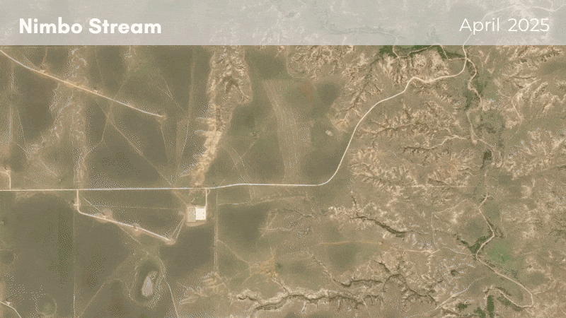
Nimbo provides a clearer, more reliable view of Earth for professional applications, with cloud-free basemaps refreshed every month so visuals are always current. Users can browse the full archive back to 2019, compare any point in time, and quickly detect and analyze changes. Careful color harmonization ensures a uniform look across territories and seasons, so maps stay readable and consistent.
1 mn
Time to plug in Nimbo
150 ms
Average map response time
260
Layers available from 2019
300
TB of Sentinel data pre-processed for you every month
World views that make sense
Give your users a reliable, up-to-date view of the world adding context to their data.
Nimbo Stream’s clear, cloud-free basemaps make measured changes easier to read, compare and trust.
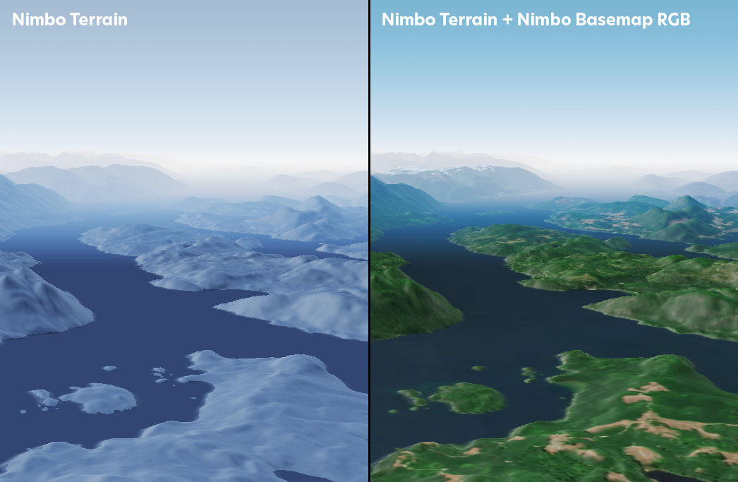
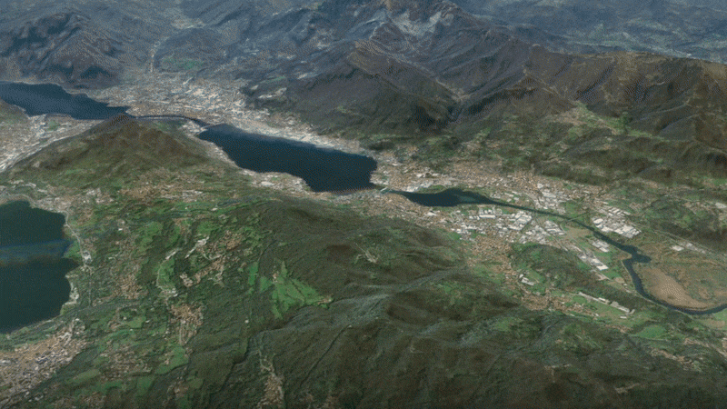
Global DEM: stream the world’s digital twin
Integrate Nimbo’s global digital elevation model (DEM) into your software or platform to provide precise and consistent terrain data to your users. Available worldwide, up to 1 m resolution.
Your up-to-date satellite source
Discover how Nimbo basemaps elevate your platform
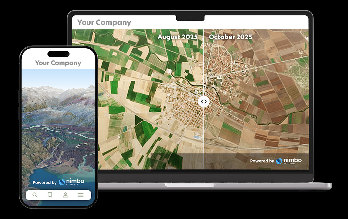
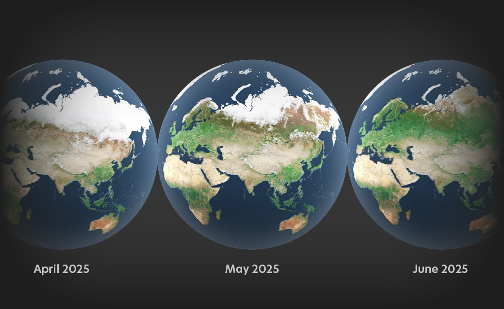
Stream Earth as it changes, fast and fluid
With Nimbo, moving from one date to another is straightforward, so you can instantly compare what has changed across time. The experience stays smooth throughout, with tiles loading quickly and navigation remaining clear and responsive.
Quick integration, smooth workflows
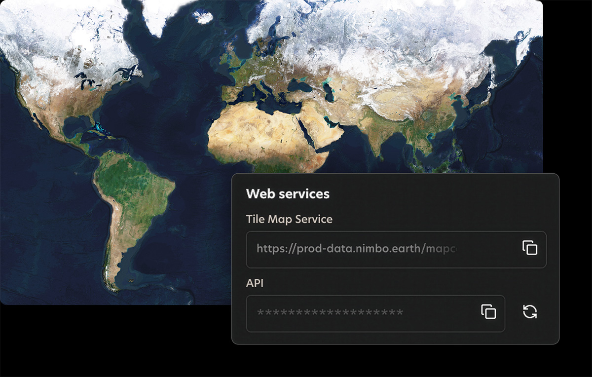
Nimbo connects easily to existing platforms through standard TMS and WMTS services, making integration quick and smooth. Add the service, set your preferences, and your basemaps are ready to stream inside your tools.
Always up-to-date
Up to 2.5m resolution
2D / 3D rendering
Optimized viewing experience
Plug-and-play
NIMBO IN ACTION

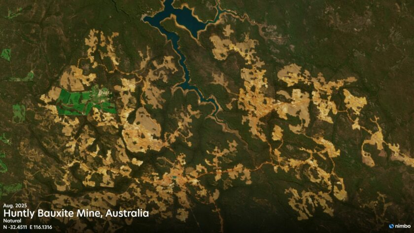
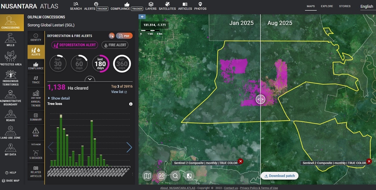
Deforestation : how Nimbo supports The TreeMap’s monitoring platform
NIMBO IN ACTION
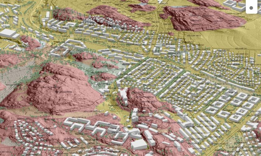
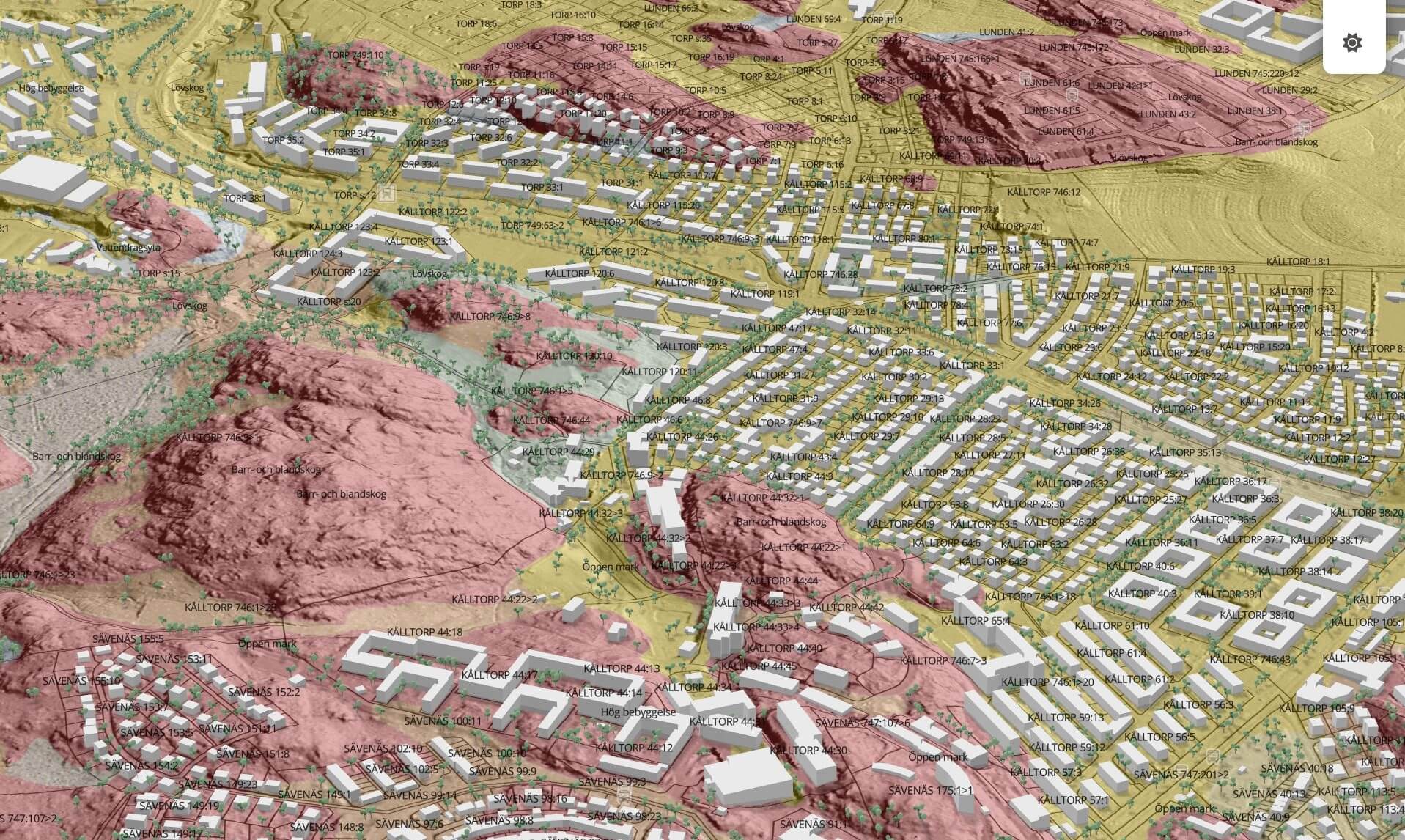
Cutting errors from 15% to 2% : how Nimbo helped Parametric improve early-stage construction planning
Basemap integration
Nimbo Stream
Get Nimbo basemaps directly into your platform or product, fit for your needs
- 2.5 m RGB
- 10 m RGB, NIR, NDVI
- Global DEM up to 1 m resolution
- Full timeline, worldwide
- TMS/WMTS integration
- Custom GC amount
Nimbo Stream specs
| Description | Monthly composites based on Sentinel-2 MultiSpectral Instrument (MSI), using 13 bands: 4 visible bands, 6 Near-Infrared bands, and 3 Short-Wave Infrared bands except radar : Monthly synthesis of Sentinel-1 “Radex” product (composite of VH, VV, HH, HV data) |
| Temporal Resolution | Monthly |
| Number of used bands | RGB :3 / Infrared : 3 / NDVI : 2 / LAI : 8 / Radar : 1 |
| Additional bands | – |
| Spatial Resolution | 2.5m or 10m |
| Global DEM | Up to 1 m |
| Bits depth | 8 bits |
| Measurement | Bottom Of Atmosphere (BOA) |
| Coordinate Reference System | UTM/WGS84 |
| Tile size | 110 x 110 km |
| Coverage | World |
| Format | TIFF |
| Access | TMS/WMTS (see documentation) |
FAQ on Nimbo Stream
How can I stream Nimbo satellite imagery in my platform?
Nimbo satellite imagery is delivered as streamed basemaps that integrate directly into web, mobile, and GIS platforms. You connect to the imagery using standard tile services, making it compatible with most mapping frameworks and engines. Once connected, imagery is served on demand, allowing your platform to display recent, cloud-free Earth views without managing raw satellite data or heavy infrastructure.
What is the resolution of Nimbo Basemaps?
Nimbo HD Basemaps are delivered at 2.5 m per pixel, offering a significantly sharper level of detail compared to standard 10 m satellite basemaps, while maintaining global consistency and regular updates.
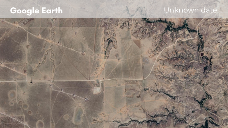
Why choose Nimbo basemaps for my platform instead of Google Earth?
Nimbo basemaps are designed for professional platforms that require current, consistent, and controllable Earth imagery. Unlike Google Earth, Nimbo provides regularly refreshed cloud-free basemaps with predictable update cycles, visual consistency over time, and clear licensing for integration into third-party applications. This makes Nimbo better suited for operational use cases, long-term monitoring, and products where imagery quality directly affects user trust.
How often are Nimbo HD basemaps updated?
Nimbo basemaps are updated every month, providing a recent and reliable view of the Earth throughout the year. This regular refresh cycle helps ensure that changes on the ground are reflected quickly, while maintaining visual consistency across updates. Monthly updates strike a balance between freshness, stability, and global coverage for production platforms.
Can Nimbo satellite imagery be used in 3D environments?
Yes. Nimbo’s Earth imagery can be used in 3D environments when paired with elevation data like Nimbo’s Global Terrain (DEM), which complements the optical basemaps with accurate topography. This enables realistic 3D visualisation and analysis by aligning satellite imagery with elevation surfaces, supporting smooth navigation, terrain rendering and environmental modelling in both web and GIS platforms.
What’s the easiest way to stream Nimbo Earth imagery in my app?
The simplest way to stream Nimbo Earth imagery into your application is by using the standard tile services (TMS/WMTS/WMS) provided in the Nimbo platform documentation. After creating a Nimbo account and obtaining an API token, you can embed these tile feeds directly into web maps (MapLibre, Leaflet, OpenLayers) or GIS software (QGIS, ArcGIS) using pre-defined URL templates. This lets your app request tiles on demand, delivering global, cloud-free satellite basemaps with fast, responsive navigation and minimal setup.