Satellite images are now part of our daily life. Those views from space are frequently used in the media to show what’s going on in the world. And turning to them to search online for a particular place has now become instinctive, thanks, in particular, to this amazing platform named Google Earth.
The thing is, when it comes to space imagery, you often get to see only what was chosen for you to see. What if you had access to a world map truly putting you in control of Earth observation ? That’s what we have to offer with Nimbor, and it really is a game changer.
Nimbo Monthly Basemaps indeed provide a great alternative to Google Earth. Why ? Because they’re the only world maps out there letting you watch our planet as it changes, with super user-friendly features to highlight those evolutions. Let’s take a look at this !
Every month, new satellite maps of the world
Google Earth has long been the go-to platform to check out the looks of any corner of our beloved planet. But one major issue with Google Earth is that you never really know how recent its images are, and if its views are really up to date. Different periods might even be mixed. Here’s an example illustrating both these limitations in Ukraine, zooming in over the Oskil Reservoir near the Kharkhiv/Donbass border:
Take a look a the pictures below. There are, first, noticeable patches of winter view appearing as you zoom in. This suggests that bits of images from different periods have been used to compose the satellite mosaic’s successive zoom layers. Hence an obvious issue in terms of data consistency.
Besides, there is no way of knowing for sure when these bits of images, retrieved from Google Earth in February 2024, were actually acquired by satellites. Some are attributed and dated, some are not. So there is no way of knowing if we’re looking at the current lay of the land. As a matter of fact, in this particular case, we’re not. It has changed, substantiously.
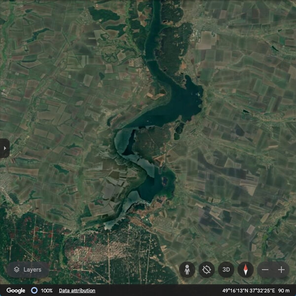
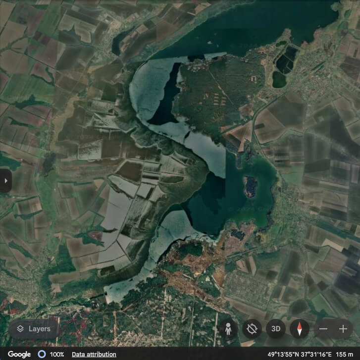
The Oskil dam (at the bottom) was indeed blown up more than one year ago as the Ukraine war raged on, draining most of the reservoir. The landscape has thus experienced a massive transformation. Compare the Google Earth view with Nimbo’s rendering of the very same area:
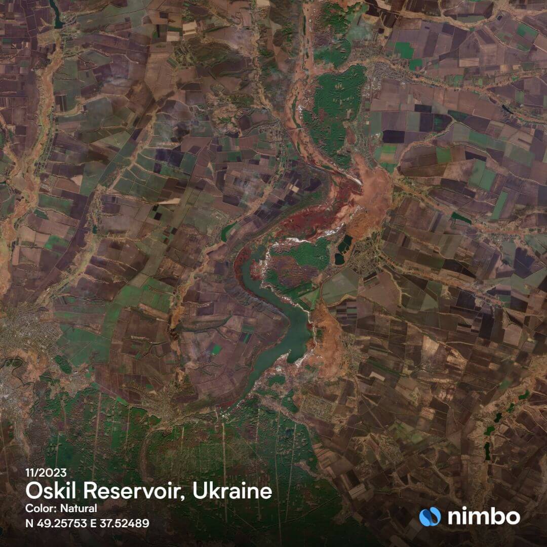
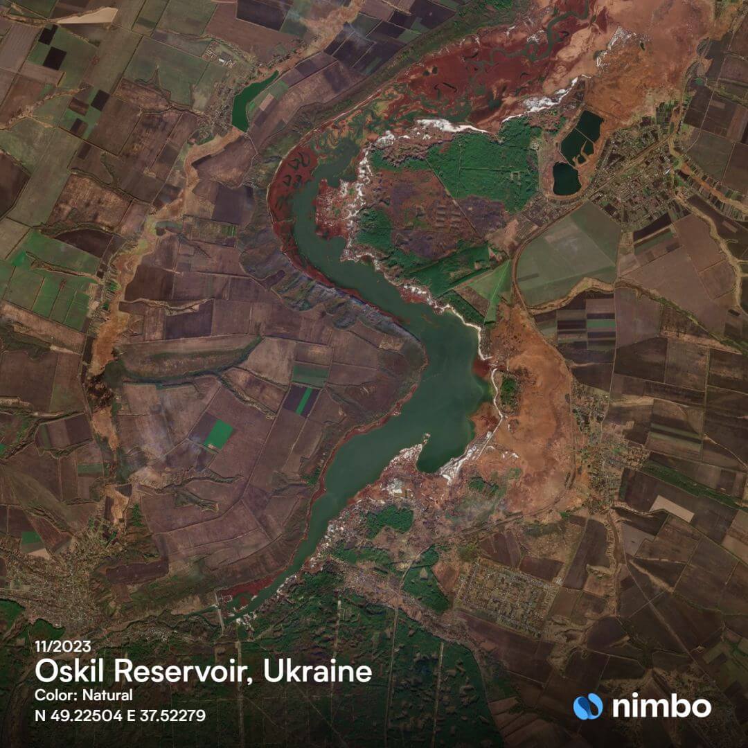
First we have a date, November 2023 and an image matching what was going on the ground during this period. What’s more, the satellite view is homogenous regardless of the zoom level – that’s something we’ll discuss later on.
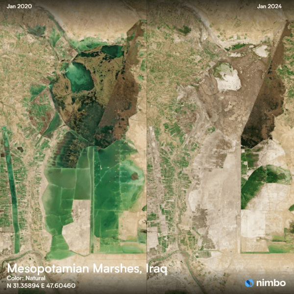
But most strikingly we do see how the region has radically changed, with large swathes of once water-covered areas now laying bare or taken up by vegetation. This illustrates one of Nimbo’s major strengths : delivering new, up-to-date satellite maps of the world every month, letting everyone track land evolutions.
This consistent and recent information that we can’t have in Google Earth, Nimbo will provide. That’s because with each month come updated images, based on the most recent acquisitions by the Sentinel missions from the EU’s Copernicus programme.
Imagery resolution on Google Earth and Nimbo
The Nimbo Earth Online platform and the corresponding Nimbo Monthly Basemaps for GIS softwares will provide you with up-to-date satellite maps of the Earth. But make no mistake : they won’t let you see your house. Except if it’s really big. Our mosaics indeed rely on Copernicus’s Sentinel imagery, with resolutions going up to 10m per pixel. Thanks to AI-powered resolution enhancement processes, Nimbo even goes further, up to 2.5m per pixel. In comparison, Google Earth’s views are much sharper, up to 15 cm per pixel. An illustration below over Hejiang County in China.


So, true, resolution-wise, Nimbo is no match for Google Earth, which assembles images from different sources. These range from high-resolution views like Copernicus and Landsat to very-high-resolution satellite images from commercial providers like Maxar Technologies or Airbus. The latter provide the most precise images, but these are expensive to produce and can’t be updated at will to cover the entire globe… Which takes us back to point #1 on image recency. Let’s zoom out:
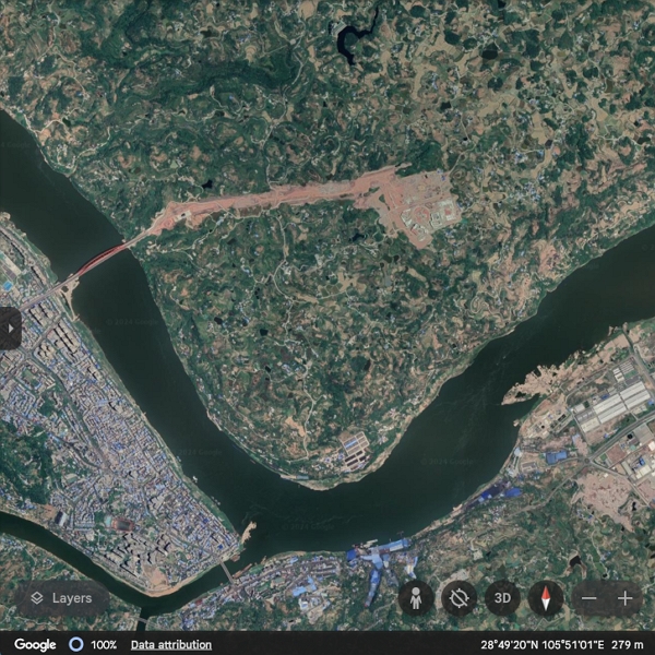
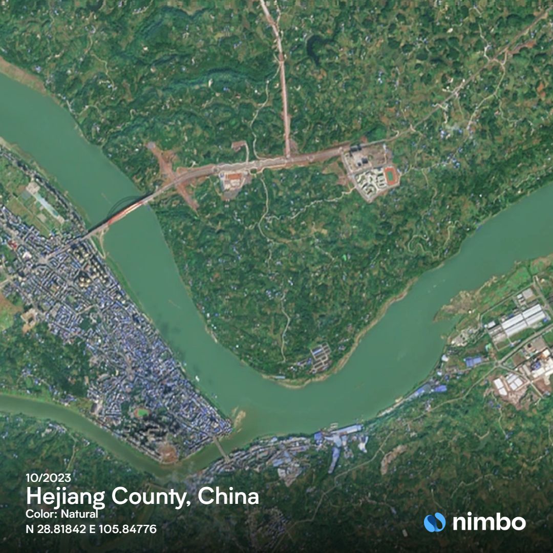
Precise as it is, Google Earth’s image above – also captured on the platform in February 2024 – is missing some important information, starting with the new roads going North and East of the central built-up area. This sums up the alternative: either you’re after precision imagery, and Google Earth’s will be your destination of choice, or you’re looking for true-to-current-reality satellite views, and Nimbo Earth Online should be your first pick.
The clearest satellite imagery source online
Well, you will know it if you are an expert in geospatial analysis: there are other sources available online to get the most recent images of the Earth. The European Union’s Sentinel imagery, for one, can be accessed for free from the Copernicus data space ecosystem. Another way to explore those images is to use Sentinel Hub’s EO browser. On the US side, Landsat imagery can also be downloaded for free from the USGS’s EarthExplorer platform.
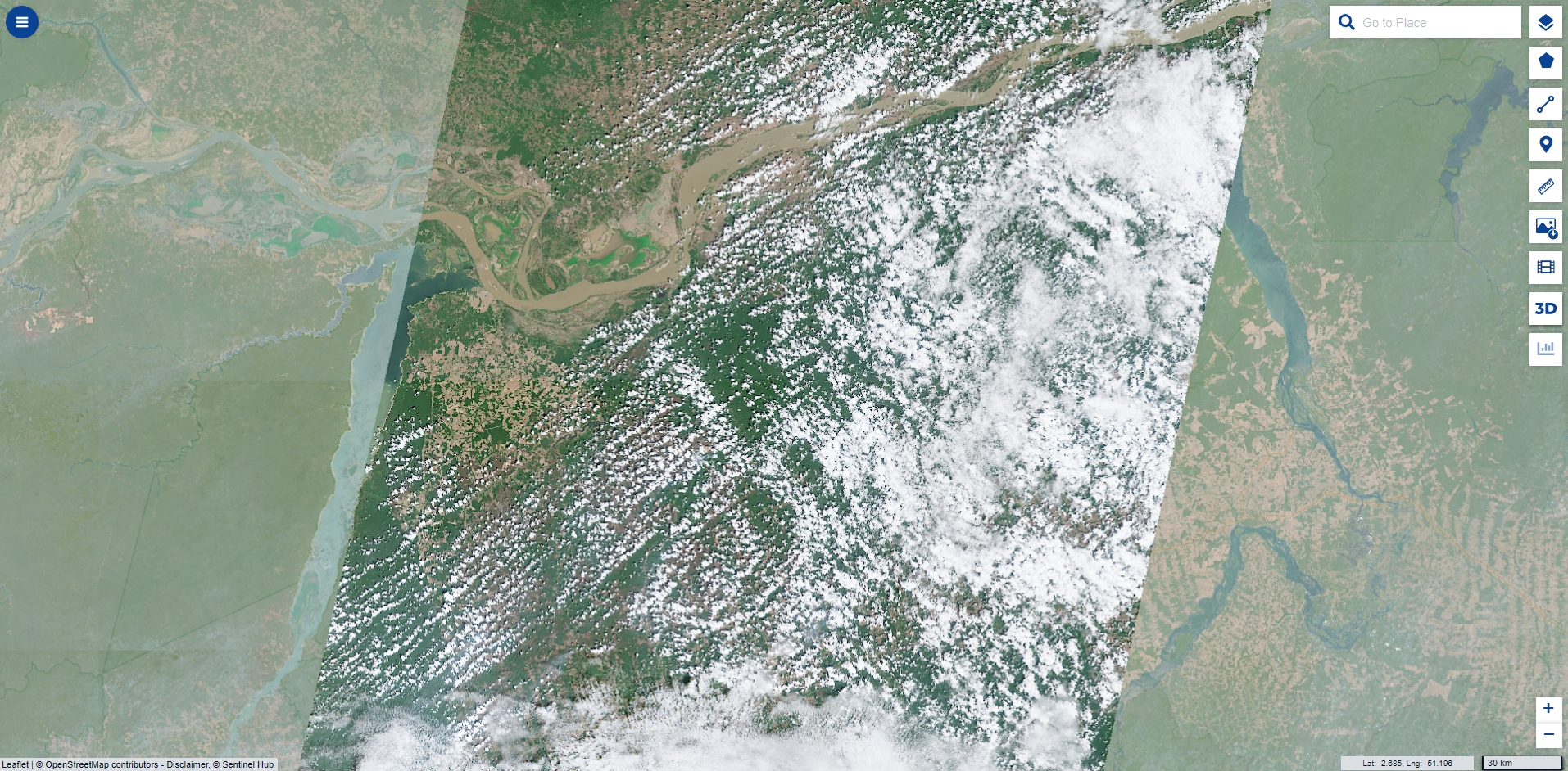
Problem : these sources give you access to raw satellite images, implying a few shortcomings. First, for a given date, only an imaging swath will be available, mirroring the satellite’s trajectory. Then there is a high possibility that, on said date, clouds will obstruct the view, so that the user will have to browse to the next “clean” date available. Finally, colorwise, raw satellite views are no easy material to translate onto our computer screens. They often must be enhanced with “false colors” for users to get a comfortable vision.
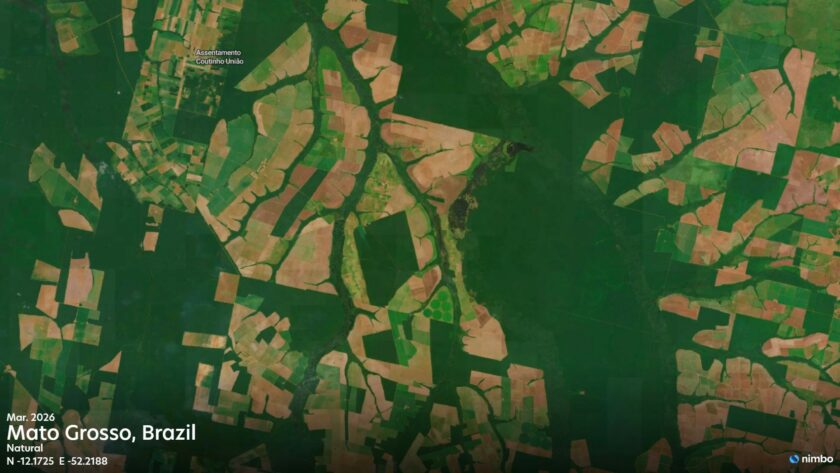
That is were Nimbo comes in. We have designed artificial intelligence processes to ensure that clouds are removed, producing satellite maps where every patch of land is unveiled. An example below over the State of Pará in Brazil: what it can look like at a given date on a raw imagery platform (Copernicus browser in that case), then for the corresponding month on Nimbo.

Another part of the job is to make sure that these world maps will be pleasant to look at. This implies converting the 16-bit colors acquired from space imagery into the 8-bit format of our daily screens. To put it simply, this comes down to stuffing 12 eggs in a 6-box, without crashing any.
We have achieved this and the result is a seamless world map with vivid colors, where some others satellite visualizations tend to be dull. Vivid, and homogenous too, meaning that an identical element of landscape will be depicted in the same color, regardless of its location on Earth. That is why, where a platform like Google Earth provides displays with varying, patchy colors as you zoom in, Nimbo’s satellite views are perfectly seamless and their colors stable at any scale.
Satellite maps everyone can use and share
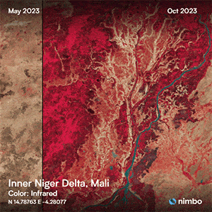
Another downside about the above-mentioned satellite imagery sources is that they are a bit difficult to handle for non-experts. And that, too, is something Nimbo is providing for. The Earth Online platform comes with a bunch of user-friendly features to explore our stack of 200+ monthly satellite maps since October 2019. Yes, 200, since every month since October 2019 is available in four data layers : natural color, infrared imagery, NDVI (vegetation health) and radar. That, too, is something Google Earth won’t provide.
And there’s other features to make the most of it. As you navigate these satellite maps, a set of tools are available for you to explore further : split and swipe to compare the same place at two different times, timelapse to create your own animation over your zone of interest, an option to measure distances and areas…
Last but not least, there is an export feature to download your findings, and easily share them with your communities. We have selected some of ours and put them on display – fancy a peek at our Nimbo gallery ?
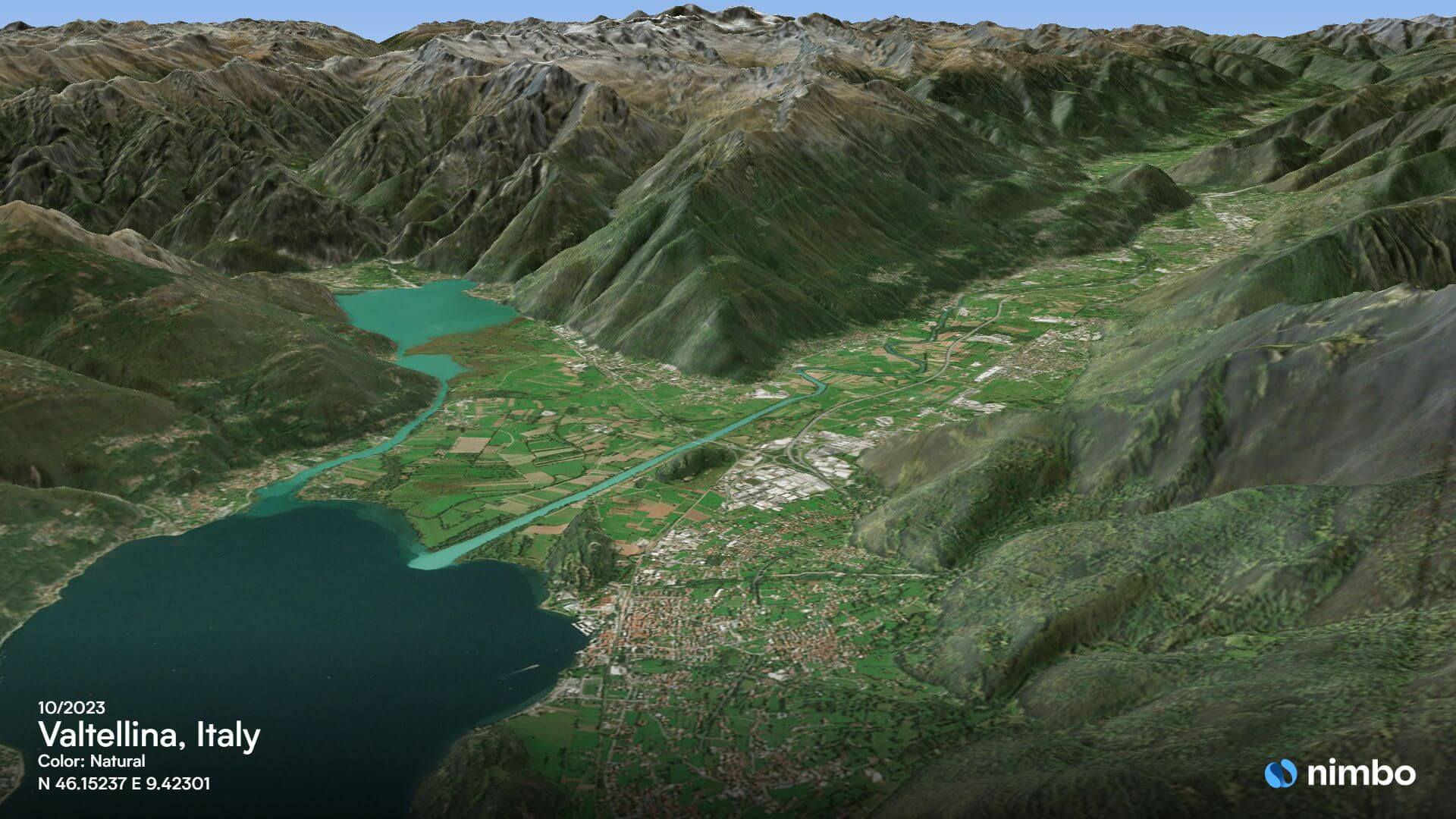
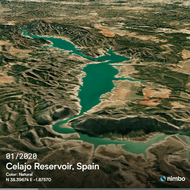
Yet more: as shown by the timelapse above, Nimbo Earth Online’s satellite maps can be enhanced with 3D vision simply by clicking on the corresponding button. This obviously rings a bell : three dimensional view is also a well-known feature available in Google Earth. Nimbo’s won’t be as resolute, of course, and won’t include the impressive 3D building view that Google Earth proposes. But, once again, Nimbo 3D satellite maps combined with monthly updates open up other exciting possibilities.
Looking at Earth in a new perspective
Nimbo as been labelled in the press as the new “rival” to Google Earth. Of course it is not. The platforms complement each other as their focus is different: Google Earth will bring you the globe in utmost detail, will Nimbo documents its evolution on a high-frequency basis. Until now, that latter possibility was the preserve of experts, who knew how to navigate raw satellite imagery sources. Now with Nimbo, clear, up-to-date Earth maps and easy ways to make use of them are in anyone’s hands. Oh yeah, and did we mention it ? Just like Google Earth, Nimbo is free, all you have to do is sign up and start exploring Earth online !