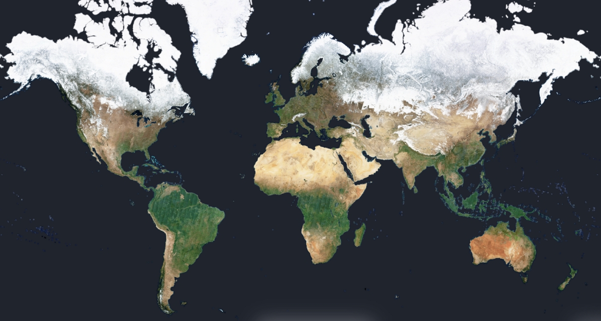
In need of recent satellite images for your QGIS project ? We’ve got good news for you: cloud-free basemaps using Sentinel imagery, updated every month, worldwide. And a few clicks away from your favorite GIS software. Here’s how it works.
Looking for the right basemap to upload in QGIS can be a hassle. Especially when it comes to satellite imagery : either you opt for a predesigned basemap service, hoping it won’t be too outdated, or you load raw Sentinel satellite data, hoping it won’t be too cloudy. That’s why Nimbo proves particularly handy for geospatial analysts: it’s got everything covered all at once. Anywhere on Earth, during the month of your choosing, and without clouds blocking the view, all of this extra easy to use through the Earth Basemaps QGIS plugin.
Global satellite basemaps for QGIS
That’s the first option: relying on a predesigned basemap coming from the usual players, like Google Earth, Bing Maps, Esri… These can be loaded into QGIS in a blink of an eye by adding the service’s URL through the XYZ tile tool.
Great. Or is it ? It depends what you’re after. There are two issues here. First, consistency : these are not homogenous basemaps, but mosaics reconstructed from various imagery providers: Copernicus and its Sentinel imagery, but also Airbus, Maxar, Planet…
Also, the satellite images merged into these mosaics can come from different seasons, displaying various contexts and colors in a single image of a given environment. All of this itself prone to variations as you zoom in or out. We detailed this issue in another article comparing Google Earth with Nimbo.
Which leads us to the core issue : time. Although providing very high spatial resolution, those predesigned basemaps cannot be relied upon if you need temporal information. They won’t do if you’re looking for up-to-date imagery of your area of interest, or what it looked like at specific dates. The logical alternative is to resort to raw satellite imagery to obtain the latest acquisitions or acquisitions at the desired dates. And there indeed are QGIS plugins letting you retrieve Sentinel data. But that does not mean you’re out of the woods.
Loading raw Sentinel imagery into QGIS
If, for lack of recency, the traditional basemaps do not fit your purposes, there’s always the possibility to work on the latest Sentinel acquisitions in QGIS. These satellite images can be downloaded from various sources, starting with the Copernicus data space ecosystem. But Sentinel imagery can also be directly loaded into QGIS from various plugins, like Sentinel Hub or SCP.
The thing is, you’ll have to deal with cloud coverage. Potentially their shadows, too. So you’ll have to sift through the available images of your zone of interest until you find the right date. This can be time-consuming, and that’s basically why satellite basemaps come in handy. Except that they may not be recent enough. Full circle, or it was before Nimbo’s Earth Basemaps came out.
Sentinel data for QGIS: the best of both worlds with Nimbo
Cloud-free, homogenous basemaps updated every month : that is what Nimbo brings in to fill the gap. These preprocessed worldwide satellite views, zoomable up to 10m/px, are the easiest way to get recent Sentinel imagery into your QGIS.
These have been crafted in-house using advanced deep-learning technique for cloud removal and color harmonization: Sentinel acquisitions cleared, stitched and merged so as to provide a unique basemap for each and every month since October 2019. Or rather, four unique basemaps, since Nimbo’s Earth views come in four different layers : RGB, NIR, NDVI and radar.
Last but not least: these basemaps can be accessed for free, and very simply.
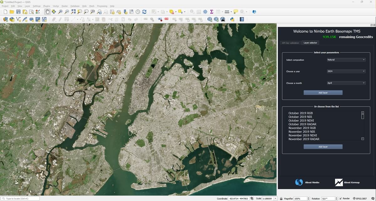
Nimbo in QGIS: Sentinel basemaps as easy as it gets
The first step to retrieve these satellite views into your QGIS software is to create your Nimbo account. This will be swiftly done via the Earth Online login page. Once this operation is completed, you will be logged into the Nimbo Earth Online platform. It is fun and you can try and explore it, but what you want is to load the basemaps into QGIS. So head for the plugin section of your software and look for Nimbo.
Once the plugin is installed, you’ll just have to enter your Nimbo IDs or API key (available from your Nimbo account) to access the whole catalogue of Nimbo’s monthly basemaps crafted from Sentinel imagery, with 60,000 geocredits to browse them. This allocation is renewed on the 1st of every month, so if you run out of credits, you can either wait for the next month, or get in touch with us if you need to upgrade to a paid plan.