Parametric’s Hektar solution now integrates Nimbo Terrain stream to bring architects and developers reliable terrain insight from day one.
Early-stage design succeeds or fails on the quality of its terrain data. For Parametric Solutions, creators of the site-planning platform Hektar, enhancing the accuracy of this layer became increasingly important as their user base grew.
After exploring several ways to improve terrain precision using the data sources available, the Swedish company turned to Nimbo Terrain. This DEM integration instantly raised their accuracy, simplified workflows and strengthened user confidence.
High-precision terrain data for early-stage planning
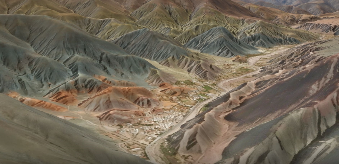
Topography influences almost every early design decision: building-to-ground interfaces, cut-and-fill volumes, mass balance, rainwater behaviour, slope constraints and more. But reliable elevation data isn’t always easy to obtain in a form that professionals can apply directly.
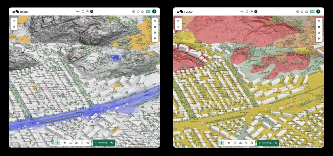
Before using Nimbo, Hektar relied on Mapbox’s global Digital Elevation Model (DEM). It offered a broad overview of relief, but lacked the detail needed for quantitative feasibility assessments. As Erik Forsberg explains:
“The accuracy wasn’t very good. It captured the general structure, but it was all very smooth. We could be off by 10 to 15% on mass-balance calculations.”
Such uncertainty can snowball into wrong decisions later in the project, forcing redesigns or delaying development.
When national DEMs exist but remain unusable
High-quality elevation models did exist, notably those published by Sweden’s national mapping agency. But these datasets came only as downloadable GIS files, not as streamable data.
They required technical handling, manual processing and specialised tools, creating friction that contradicted Hektar’s promise of rapid, intuitive early-stage design. Erik summarises the gap clearly:
“I did years of research and couldn’t find anyone providing this data in this way, until I found Nimbo. It’s basically the only player offering this kind of high-precision terrain as an API.”
The problem wasn’t the DEM itself. It was the absence of a usable delivery method. That’s exactly the need Nimbo was built to meet.
A construction-ready Terrain API that integrates in minutes
Switching Hektar to Nimbo’s terrain data stream took only a few minutes, maintaining the application logic with just a direct substitution of the terrain endpoint in their existing Mapbox-based setup.
“Integration was super easy. We basically switched the URL and it worked. And it even solved a scaling issue we had with Mapbox without us expecting it.”
With Nimbo, Hektar gained:
- a high-quality national-source DEM
- consistent terrain resolution across regions
- streaming access, eliminating file downloads and user-side uploads
The result was an elevation layer that felt native from day one, without the burden of maintaining custom pipelines.
From ±15% error to ±2% accuracy with Nimbo Terrain stream
Nimbo’s elevation data didn’t only improve workflow speed. It materially improved the accuracy of key engineering metrics.
“Our mass-balance accuracy went from ±10–15 % to about ±2 %. And several users have already told us they appreciate the increased precision. The tool simply feels more trustworthy.”
Cut-and-fill estimations, slope identification and early drainage considerations now respond to real terrain, not approximated models. Users can explore site options and receive immediate, reliable feedback without touching GIS tools or conducting manual surveys.
Raising the standard for terrain data in design tools
For Parametric Solutions, adopting Nimbo wasn’t just a technical update. It redefined what early-stage design tools can expect and even demand from topographical data.
Reliable, accessible DEM streaming removes barriers that previously slowed ideation or led to avoidable design errors. It lets architects and developers start with ground truth from the very first sketch.
With Nimbo supplying crucial elevation data, Hektar continues to scale as a design copilot — one that begins every project on solid ground, literally.
Discover what Nimbo could unlock for your platform
Get high-precision terrain data directly into your tools, plug-and-play.