Behind all mapping and Earth observation platforms lies a core concept : dividing our planet’s surface into tiles to facilitate its exploration. Here’s where it comes from, and how it works.
Digital mapping has undergone a remarkable transformation over the past two decades, revolutionizing how we navigate the world. Platforms like Google Maps, Open Street Map, or Nimbo Monthly Basemaps uses a tile system that has become the global standard for delivering maps efficiently. But where did this technology originate, how does it work, and what makes it so powerful? We thought that its origins and techniques were worth a good look.
A brief (pre)history of the tile system
The modern tile system that we rely on today emerged alongside the rise of interactive web mapping. Before that, digital maps were often static images or complex renders that made seamless navigation difficult. To understand the evolution of this technology, we need to go back to the early 1990s.
Terravision: German Pioneer of tile display
One of the earliest examples of a tile-based system in an interactive interface was Terravision, a project developed by the German company Art+Com. This project, conceived before the era of Google Maps, allowed users to navigate a 3D globe in real time by loading geographical tiles progressively. Its 3D interface, powered by satellite and geospatial data, prefigured what Google Earth would popularize years later.
Terravision divided the Earth’s surface into small sections (tiles) that were loaded on demand, allowing for a seamless exploration experience without requiring the entire map to be loaded at once. This was revolutionary in a time when bandwidth was still quite limited.
This period of technological innovation and the story behind Terravision was popularized by the Netflix series The Billion Dollar Code, which dramatized the legal battle between the creators of Terravision and Google, as they claimed Google Earth had infringed on their early invention. While the legal case was ultimately decided in favor of Google, Terravision remains a key chapter in the history of digital mapping technology.
Google Maps and Where 2 Technologies
While Terravision pioneered early innovations in tile-based mapping, it was Google that brought this concept to the mainstream with the launch of Google Maps in 2005, followed shortly by Google Earth. A key part of this success was due to their acquisition of Where 2 Technologies, an Australian startup that played a critical role in the development of the technology behind Google Maps.
Where 2 Technologies, founded by brothers Lars and Jens Eilstrup Rasmussen, was a small but highly innovative company with a clear mission: to make digital maps more interactive and user-friendly. At the time, most online maps were static, requiring users to refresh the page whenever they wanted to move around or zoom in. This approach was not only slow but also frustrating for users. The founders of Where 2 Technologies believed that maps should behave more like applications, allowing users to pan, zoom, and explore effortlessly, without waiting for large images to load or reload.
To achieve this, they needed a system that could handle vast amounts of geospatial data without overwhelming users’ devices or internet connections. This is where the tile system became essential.
Where 2 Technologies developed a web-based mapping system that divided the Earth’s surface into small, manageable sections known as tiles. Instead of loading an entire map all at once, their system only loaded the specific tiles that were visible on the screen at any given moment.
Google’s tile system built on this idea, dividing the Earth’s surface into a grid of small images at various zoom levels (Z). Each tile at a given zoom level was referenced by two coordinates, X and Y, allowing users to load only the necessary tiles for their view. As users panned or zoomed in and out of the map, the relevant tiles were dynamically loaded, creating the illusion of a seamless and continuous map. This dramatically improved the performance and user experience, allowing maps to be navigated in real time without long load times or delays.
Google saw the potential in this revolutionary approach and acquired Where 2 Technologies in 2004. The tile-based system they developed was integrated into Google Maps, and it quickly became the backbone of the platform’s success. This innovation not only made maps faster and more responsive but also set a new standard for how people interact with maps online.
By breaking the map into smaller, independently loadable sections, Google Maps could efficiently handle massive amounts of data, making it scalable for millions of users around the world. This system allowed Google to offer a real-time, interactive mapping experience that became indispensable to everyday users and businesses alike.
The technology that Where 2 Technologies pioneered, combined with Google’s resources, laid the foundation for what is now a global standard in web-based mapping. Today, the tile system is used not only by Google Maps but also by many other platforms, including MapTiler and NIMBO, continuing to shape the way we explore and navigate the world.
What exactly is the tile system (and how does it work) ?
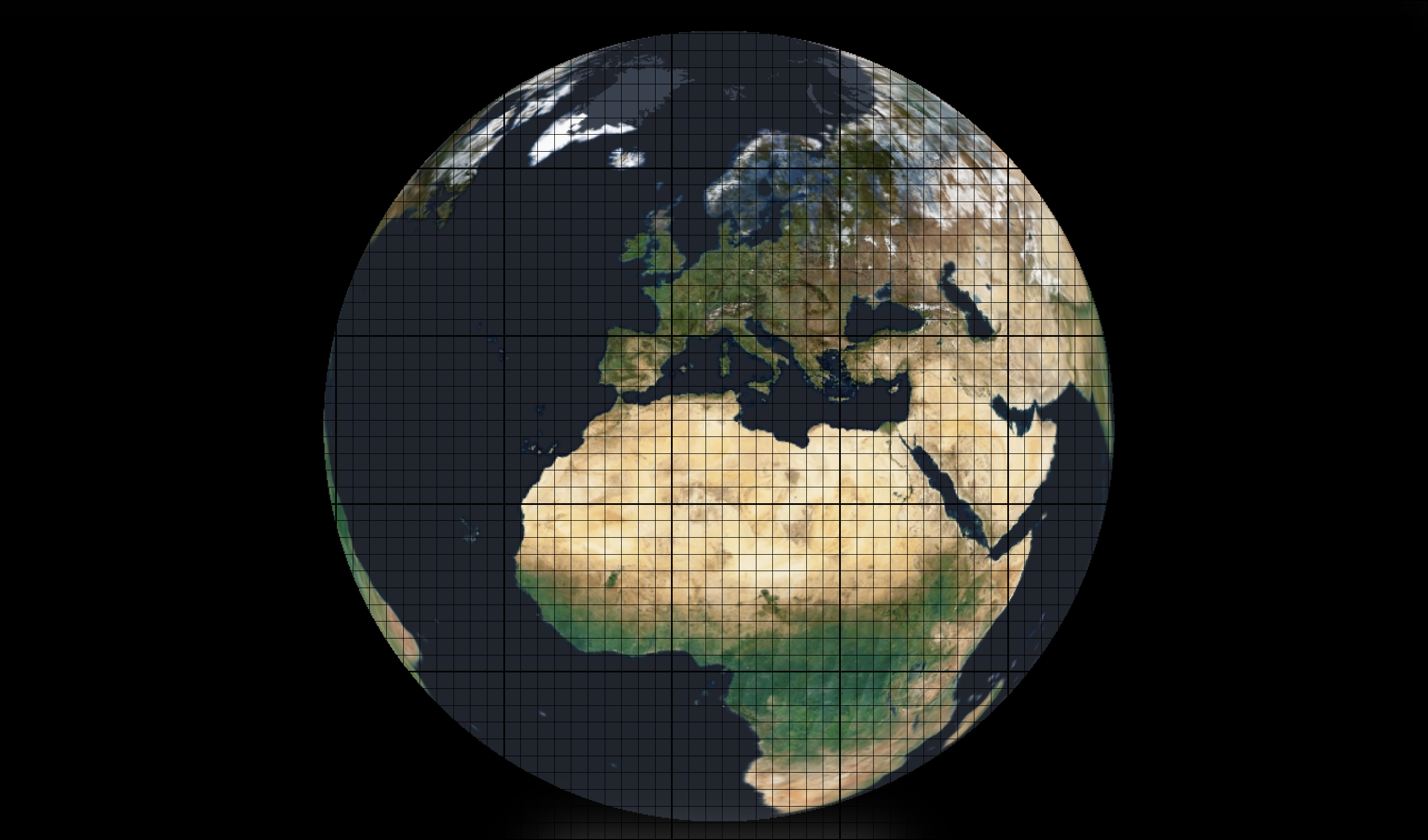
The tile system is based on an approach known as Mercator Web projection, which projects the Earth as flat maps divided into small square sections, or tiles. At each zoom level, the globe is subdivided into progressively smaller tiles. Here’s how it works:
First things first: what is a tile ?
In digital mapping, a tile is a small, square image that represents a portion of the Earth’s surface. These tiles are used to build maps dynamically, allowing users to interact with only the relevant sections of the map at any given time. Instead of loading a massive, high-resolution image of an entire map (which would be slow and resource-intensive), the tile system breaks the map into smaller, more manageable pieces. Each tile is loaded independently based on the user’s current view and zoom level, enabling smooth and efficient navigation.
It also means that updates to specific regions of the map—whether through new satellite imagery or changes in infrastructure—can be applied without needing to refresh the entire map. Only the tiles covering the updated areas need to be modified, making the system highly modular and flexible.
A key feature of tile systems is their scalability—at lower zoom levels, fewer tiles are needed, and at higher zoom levels, more tiles are used to show greater detail. These tiles are typically referenced using an XYZ coordinate system, with X and Y indicating the position of the tile on the grid and Z representing the zoom level.
Tile size: striking the right balance
Tiles are commonly rendered at sizes of 256×256 pixels or, more recently, 512×512 pixels. These sizes are not random ones: they have been chosen to facilitate computing and loading. First, 256 and 512 boast the very convenient property of being powers of 2 (2^8 and 2^9, respectively). Using powers of 2 simplifies the math for dividing the map into tiles at various zoom levels. This creates a clean, predictable grid, making it easier to calculate which tiles need to be displayed based on the user’s position and zoom level.
Tiles that are 256 pixels wide or tall are also computationally easier to handle for the majority of devices, especially older computers and mobile phones with limited processing power. Larger tiles (such as 512×512 pixels) provide higher-resolution images but require more memory and bandwidth to render.
And then there’s the bandwidth issue. When Google Maps launched in 2005, internet speeds were significantly lower than today. The goal was to ensure fast loading times even on slower connections, so smaller tile sizes (256×256 pixels) were chosen as a balance between image detail and the amount of data that needed to be downloaded. These smaller tiles made it possible to load just the needed sections of the map quickly.
The decision to standardize on 256×256 pixels initially, and later 512×512 pixels in some platforms, strikes a good balance between performance, scalability, and the level of detail provided. While 256×256 tiles are still widely used due to their lightweight nature, 512×512 tiles are becoming more common as they allow for higher resolution with fewer requests—especially useful for modern, high-resolution displays.
Now that we understand the importance of tiles and their dimensions, let’s explore how these tiles are arranged and identified in a tile-based mapping system.
Web Mercator Projection: the (almost) perfect fit for tiles
The Mercator projection is a cylindrical map projection introduced by 16th-century cartographer Gerardus Mercator. It’s widely used in digital mapping due to its ability to preserve accurate angles and directions, essential for navigation. In this projection, the Earth is projected onto a cylinder touching at the equator, which stretches areas near the poles. As a result, regions closer to the poles, like Greenland and Antarctica, appear disproportionately large compared to areas around the equator.
In the context of digital mapping, the Web Mercator projection (EPSG:3857) has become the standard. Unlike the traditional Mercator, Web Mercator assumes a perfectly spherical Earth, simplifying calculations for rendering maps on a flat surface. This projection makes for efficient tiling, dividing the Earth into a grid of square tiles, perfect for zooming and panning in modern web mapping systems. But Web Mercator is also valued for its conformal nature, as this projection preserves angles, making it ideal for navigation and interactive applications. And it’s also widely supported, allowing seamless integration of maps from different sources.
However, the Mercator projection has its limitations, especially area distortion. Regions near the poles appear much larger than they are, making it less accurate for high-latitude areas. Distortion is so extreme that maps often cut off these areas entirely.
Despite these drawbacks, the Mercator projection remains the foundation for most web-based maps due to its simplicity and compatibility with tile-based systems, making it ideal for fast, interactive map navigation.
Tile coordinates: a deeper look at XYZ
Tiles in the tile system are defined by three parameters: X, Y, and Z. The Z parameter represents the zoom level, while X and Y coordinates define the position of each tile at that zoom level. As the zoom level increases, the number of tiles doubles in both dimensions (2×2 at Z=1, 4×4 at Z=2, and so on), providing higher detail as you zoom in.
At the highest level of zoom (Z=0), the entire globe is represented by a single tile. Each additional zoom level splits the map into more tiles, allowing for greater resolution and more detailed views of specific areas. For instance, at zoom level 1, there are four tiles (2×2), and at zoom level 2, there are 16 tiles (4×4).
Here’s a table showing how zoom levels correspond to the resolution of each pixel on the map:
Tableau
As the zoom level increases, the number of tiles grows exponentially, allowing for much higher resolution and detail in specific regions of the map. For example, at zoom level 19, a single pixel represents just 30 centimeters on the ground, making it ideal for applications requiring fine detail, such as urban planning or precision navigation.
Efficient tile display through loading and caching
One of the key features that make tile-based mapping systems like Google Maps so efficient is the use of dynamic loading and local caching. These two mechanisms work together to ensure that maps load quickly and maintain smooth navigation, even when the user interacts with them in real time.
Dynamic Loading: only the necessary tiles
When you interact with a map—by zooming in, zooming out, or panning—the system doesn’t load the entire map all at once. Instead, it uses asynchronous loading to fetch only the tiles that are immediately visible in the current view. This technique reduces the amount of data that needs to be transferred over the network, ensuring that maps are fast and responsive.
At each zoom level, the visible portion of the map is split into tiles, and only the necessary tiles for that particular area are requested from the server. As the user navigates, additional tiles are fetched dynamically, while those outside the current view are unloaded. This approach optimizes bandwidth usage and allows for real-time updates without needing to reload the entire map, making the user experience much more fluid.
For example, when you zoom into a specific city or area, the map will automatically load higher-resolution tiles that show more detail, while tiles from a broader, lower-resolution view are discarded. The system continuously adjusts the tiles based on the user’s interaction, creating a seamless experience.
Local Caching: storing your favourite
To improve performance even further, web mapping systems often rely on local caching. This means that once tiles have been downloaded and displayed, they are stored temporarily on the user’s device (e.g., in the browser’s cache). If the user returns to an area they’ve previously visited, the cached tiles are loaded from local storage instead of requesting them again from the server.
This technique greatly reduces redundant data requests, speeding up the map experience for users who frequently revisit the same locations. For example, if you’re navigating around your neighborhood, the map tiles for your local area will load almost instantly the next time you view them, as they are retrieved from the cache rather than downloaded again.
Local caching also provides benefits when users experience intermittent internet connectivity. Cached tiles can be displayed even without an active connection, allowing users to access previously viewed map sections offline.
By dynamically loading tiles and caching them locally, modern web mapping systems provide a responsive, high-performance experience that scales well across different devices and network conditions. This makes tile-based mapping not only powerful but also highly adaptable to a wide range of use cases, from desktop navigation to mobile applications.
A global standard for a connected world
The tile system has revolutionized the way we interact with maps, transforming a once static experience into one that is dynamic, responsive, and incredibly efficient. Its impact extends far beyond mere convenience, fundamentally altering how we explore, analyze, and use geographic information in both everyday tasks and complex professional applications.
With the rise of mobile technology, the tile system has proved even more crucial. With millions of people accessing maps on smartphones and other mobile devices, the need for fast, responsive map services that can adapt to various screen sizes and network speeds has never been greater. The tile system delivers exactly that, ensuring that maps load quickly and provide detailed information, regardless of whether the user is on a high-speed domestic connection or a slower cellular network
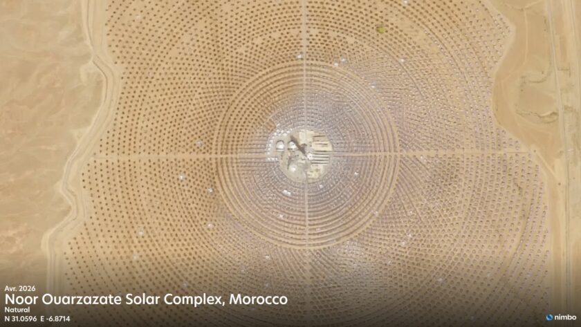
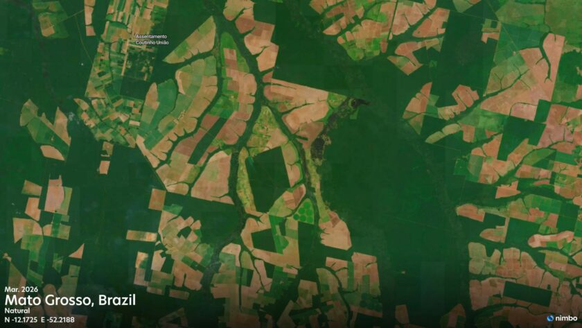
These advantages have made the tile system a fundamental technology in modern web-based mapping applications. Platforms such as Google Maps, OpenStreetMap, and NIMBO rely on this system to provide fast, reliable, and detailed maps to millions of users around the globe. The tile system supports a range of essential services, from helping users navigate their daily commutes to enabling urban planners to assess city layouts, or even assisting environmental scientists in monitoring changes in land use or climate.
In essence, the tile system is much more than just a way to load maps more efficiently. It has become the backbone of modern digital cartography, making geographic information more accessible, versatile, and useful than ever before. From the high-level strategic decisions made by governments and businesses to the everyday convenience of checking a route or finding a local café, the tile system plays a crucial role in how we understand and navigate our world. Head to maps.nimbo.earth to see how we continue to harness the power of this system to deliver cutting-edge geospatial solutions to our users, allowing them to explore and analyze the world as it changes, month after month, with unparalleled precision and speed.