GIS & Mapping
Analysis-Ready Imagery for GIS
For teams running mapping workflows, dashboards, or monitoring programs, the question is always the same: where is the satellite layer I can just use?


THE CHALLENGE
The preprocessing burden of raw imagery
Your starting point should be a clean, ready-to-use satellite layer, not a multi-step preprocessing project.
Yet, most GIS professionals are still bogged down by:
- Hours lost searching for scenes, removing cloud cover, and correcting colors.
- Map updates and dashboards delayed by weeks of image preparation.
- Field teams left working with inconsistent or outdated visuals.
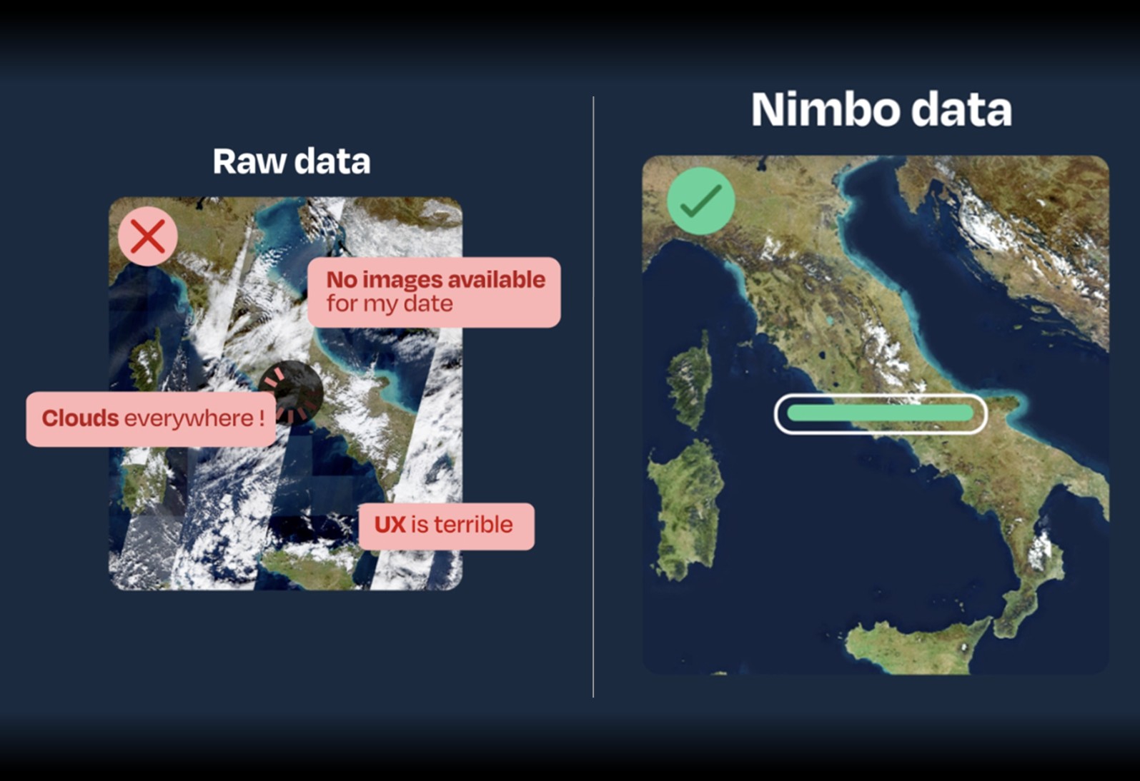
Nimbo delivers analysis-ready basemaps
so you can skip straight to the work that matters.
Ready to use
No preprocessing, no imagery specialist needed.
Continuous through time
A stable visual reference, updated monthly, starting from 2019.
Reliable in production
Precise enough for interpretation, reporting, and decisions.
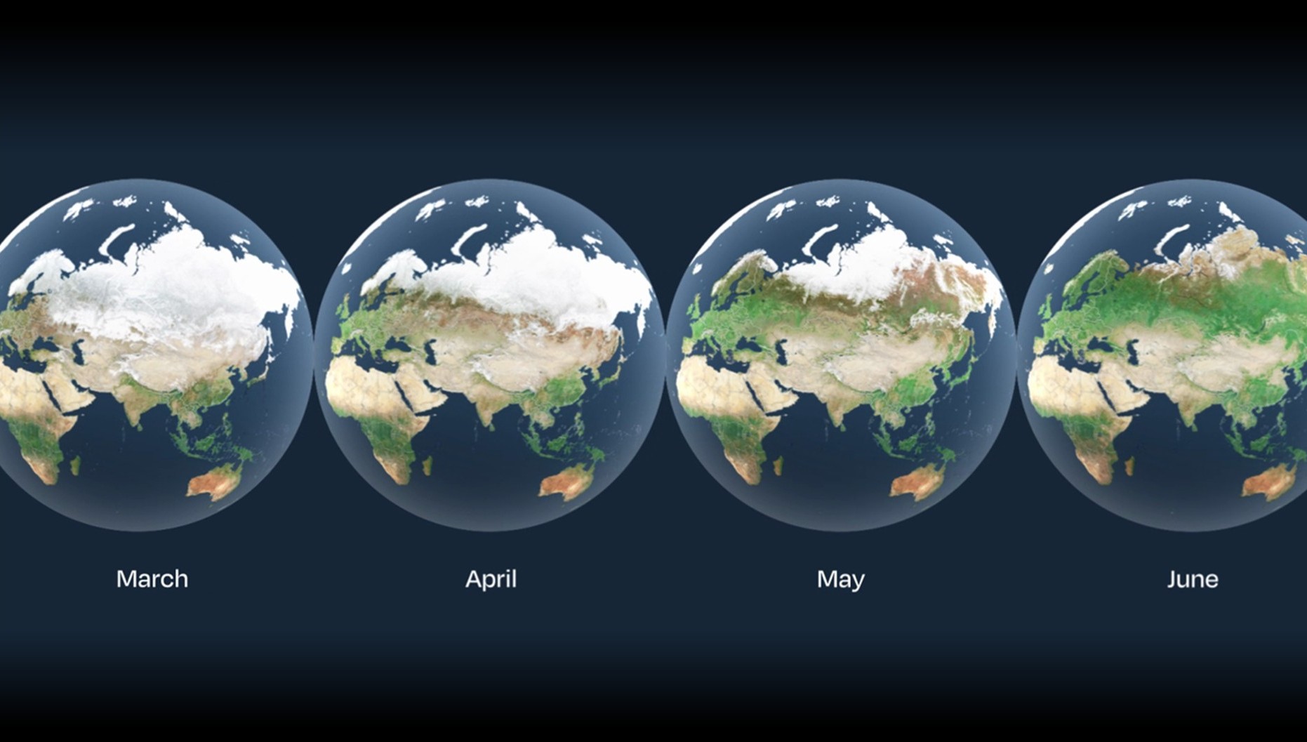
Temporal continuity
Built for time-series analysis
Tracking evolution demands consistent imagery.
When basemaps change in source, resolution, or color balance between periods, interpretation breaks down and continuity is lost. Teams need a consistent visual layer they can trust month after month for:
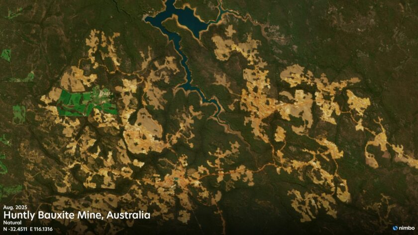
- Vegetation Monitoring: Track agricultural and forested areas with reliable monthly updates.
- Urban Change Detection: Map infrastructure growth and urban expansion across multiple years.
- Seasonal Comparison: Ensure accurate environmental reporting and regulatory compliance.
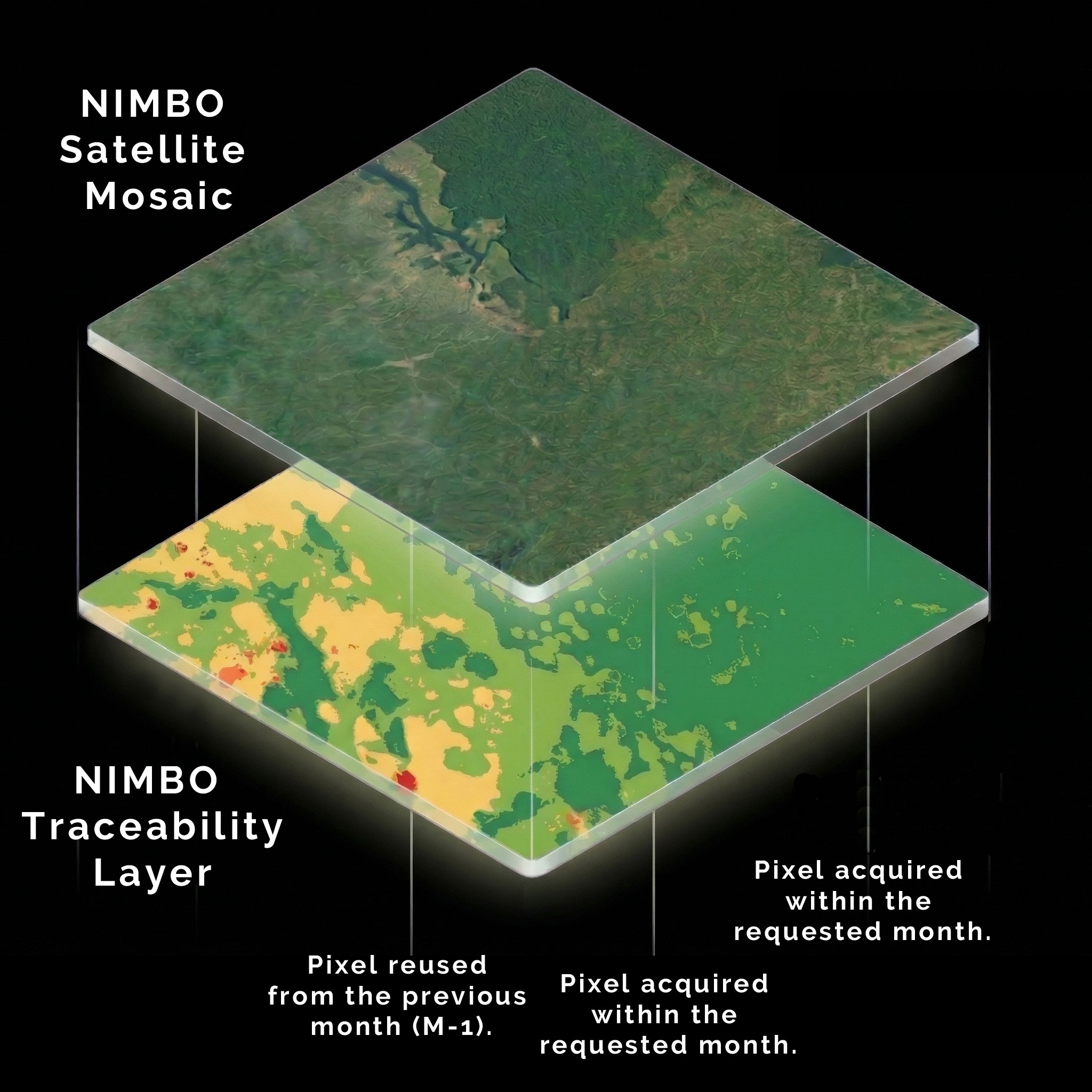
Reliability
Trace every pixel back to the source
Whether presenting to regulators, clients, or decision-makers, someone will always ask: When was this image taken?
True reliability requires spatial accuracy, visual coherence, and knowing exactly when the ground was observed. You need defensible imagery for:
- Regulatory Reporting: Provide time-referenced, verifiable visual evidence to authorities.
- Client Deliverables: Ensure your imagery quality reflects your professional credibility.
- Internal Analysis: Eliminate ambiguous basemaps to prevent unreliable conclusions.
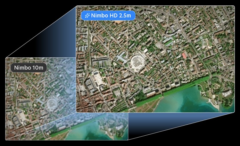
Resolution
From broad context to sharp detail
Large-area monitoring and national-scale mapping work well at moderate resolution. However, urban interpretation and infrastructure assessment demand sharper detail.
A versatile imagery stack delivers both. It provides a reliable baseline for massive areas and allows you to zoom into finer detail exactly where the project requires it:
- Regional Monitoring: Track broad land changes at 10m resolution.
- Urban Mapping: Assess infrastructure and city expansion with 2.5m clarity.
- Premium Cartography: Deliver high-end maps for publications and client reports.

Production-Ready Satellite Basemaps
Skip the preprocessing and scene management. Stream cloud-free, time-referenced basemaps at 10m and 2.5m resolution directly into your GIS via TMS or WMTS every month.