BROADCAST & MEDIA
Satellite basemaps for broadcast
Create fresher, more credible maps and on-air visuals with monthly updated satellite imagery designed for newsrooms, motion teams, and weather production.
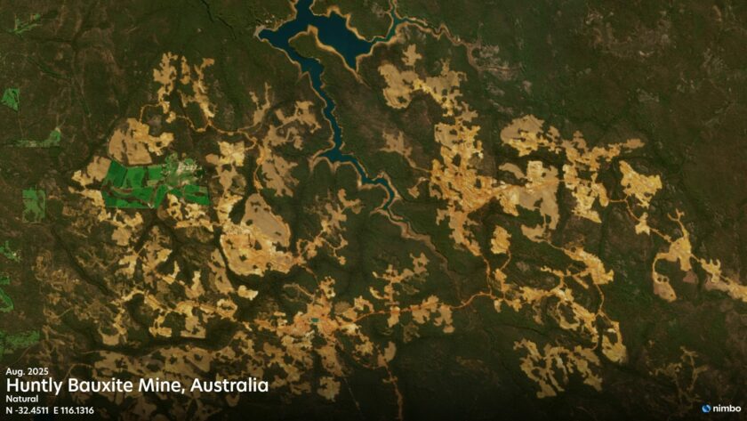
2.5 m/px
Nimbo maximal resolution
150 ms
Average response time
320 layers
Available since October 2019
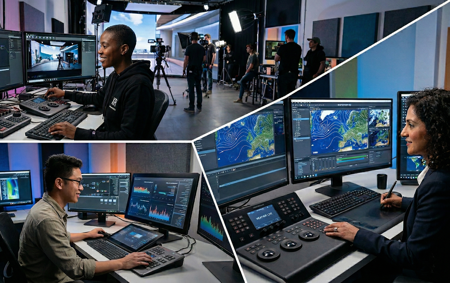
News Production
Daily news moves fast, and manually removing clouds or patching seams slows down production. Nimbo delivers consistent, monthly-updated, cloud-free basemaps reflecting the latest ground truth. With instant integration into industry-standard tools like Vizrt, Chyron, Unreal Engine, and GeoLayers 3, newsrooms can pull broadcast-ready imagery on demand, ensuring seamless 2D/3D workflows under EU data sovereignty, from planned features to breaking news. Empower your team to instantly generate:
- Studio backdrops: Clean, high-res geographic context for live news bulletins.
- 3D explainers: Terrain-matched incident reporting and fly-throughs.
- Digital tiles: Fast-loading maps for web and mobile news apps.
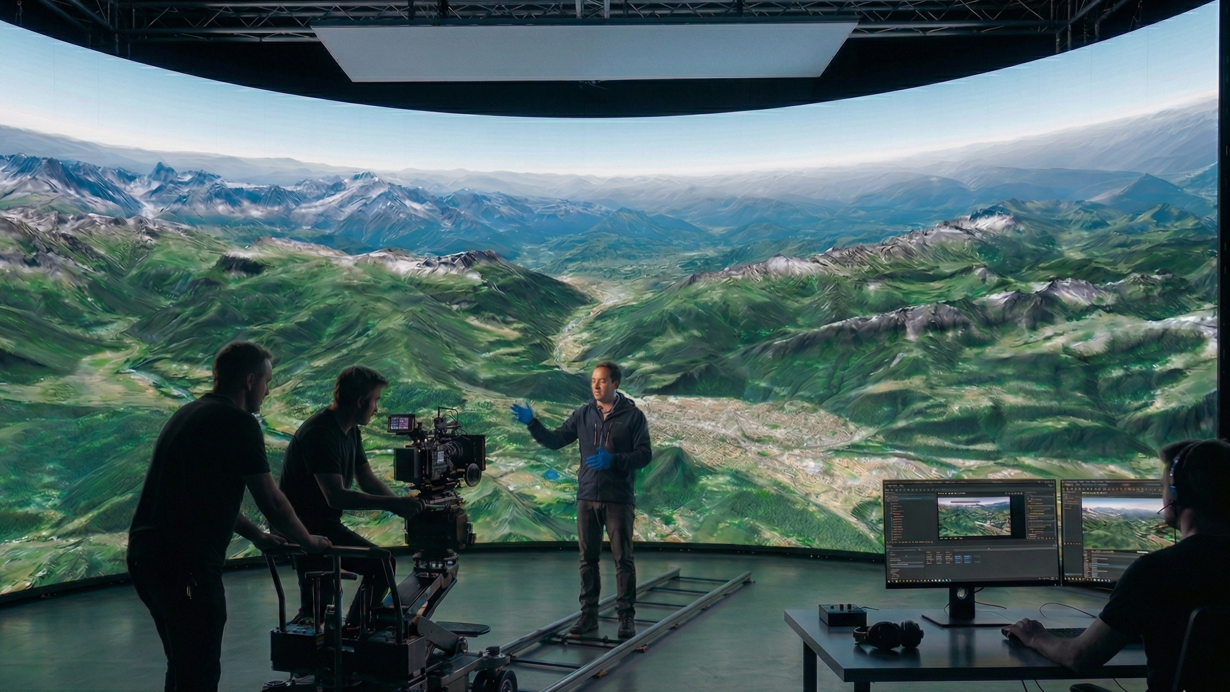
Documentary and Virtual Production
Cloud artifacts, tile seams, and shifting colors break the illusion on screen, trapping teams in weeks of manual cleanup. Nimbo delivers globally consistent, monthly-updated basemaps and matching 3D terrain. With direct platform integration and straightforward licensing, your production keeps moving with zero manual geospatial prep. Empower your team to effortlessly create:
- Virtual environments: Flawless, terrain-matched 3D backdrops for LED volumes and VFX.
- Investigative comparisons: Perfectly aligned before-and-after sequences for visual evidence.
- Feature documentaries & explainers: Artifact-free global imagery for any location without pipeline changes.
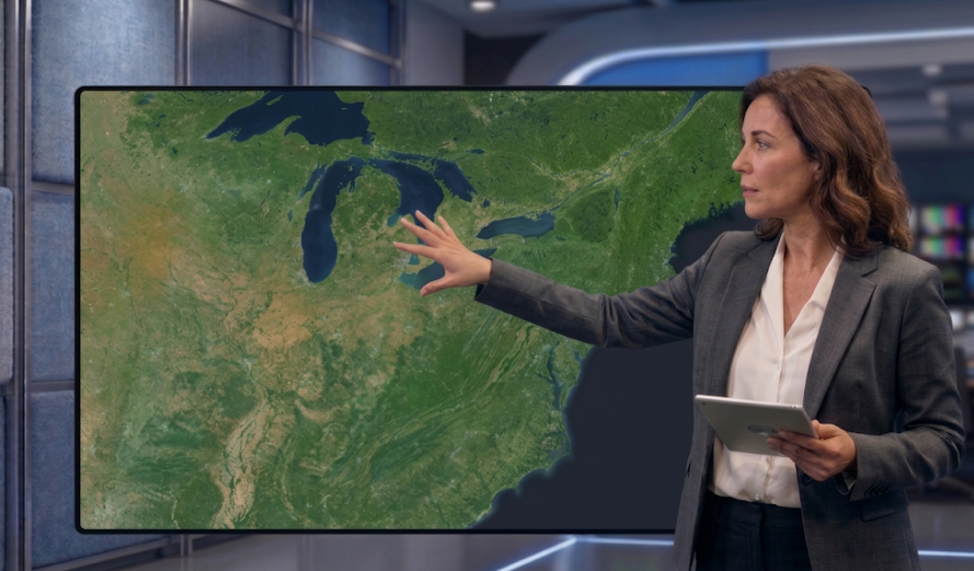
Weather Graphics
In weather graphics, visual clarity and seamless coverage are essential. Cloud artifacts and visible map seams instantly undermine user trust and block platforms from scaling. Nimbo solves this by providing globally consistent, cloud-free geospatial layers via unified APIs, delivering smooth performance and elevation-aware visuals for stunning, high-impact forecasting. Empower your team to reliably deliver:
- Geographic backdrops: Crisp basemaps for weather graphics.
- Up-to-date visualization: Fresh monthly imagery for seamless integration into 2D/3D meteorological platforms.
- EU Data Sovereignty: A fully compliant European data stack for government contracts and regulated industries.

A comprehensive map graphics and animation toolkit
Leverage a suite of professional-grade layers engineered for high-end visualization: consistent basemap, high-resolution terrain, and artistic Hillshade.
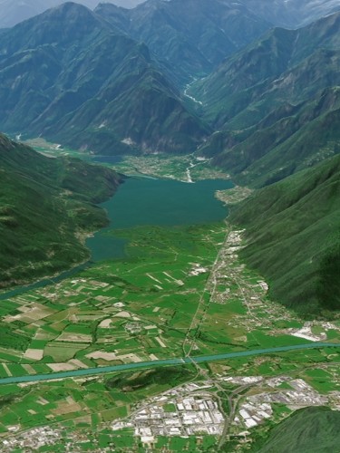
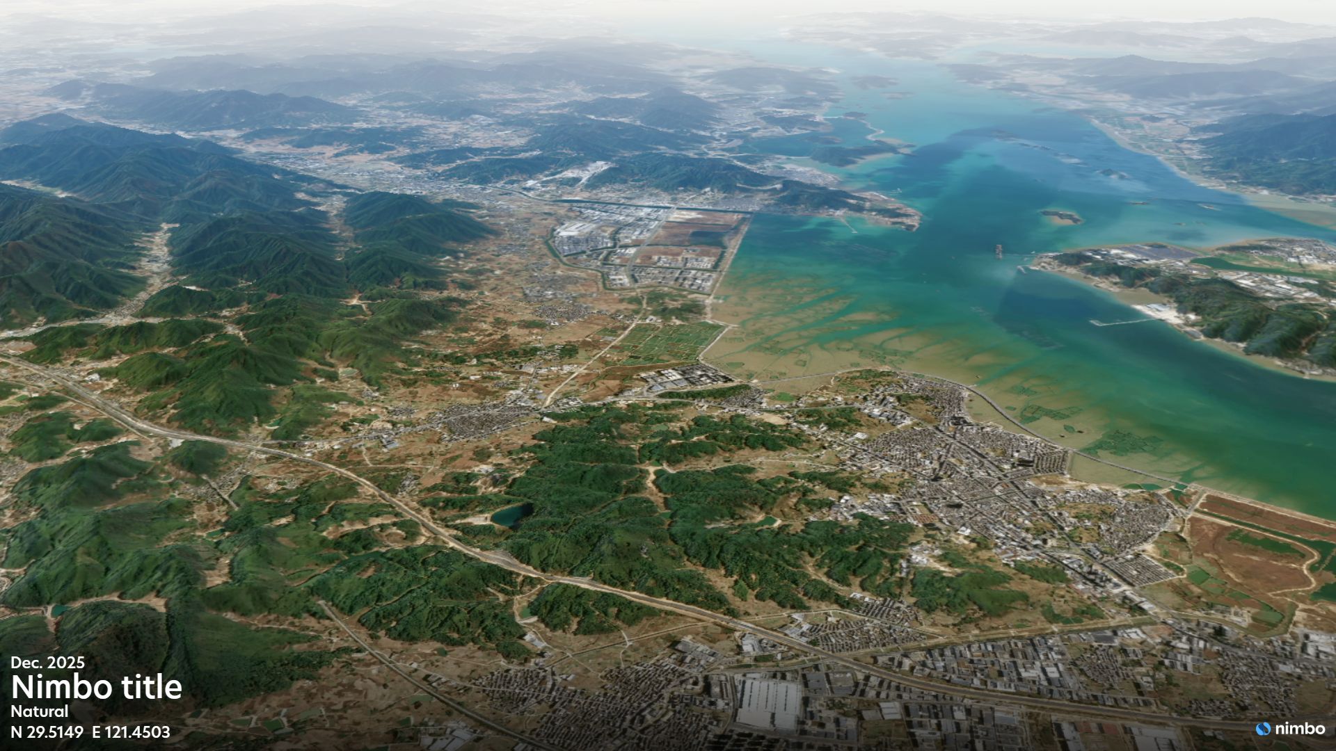
Nimbo Basemap
Pristine, cloud-free visuals for broadcast, delivering global consistency for news, weather backdrops.
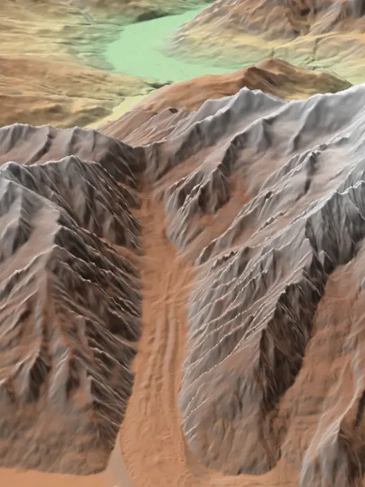
Nimbo Terrain
The high-precision 3D base for realistic mesh generation, ensuring structural accuracy for cinematic fly-throughs and geographic explainers.

Nimbo Hillshade
Instant, high-contrast relief for map graphics, delivering professional depth and textures with zero processing time.
Live Earth straight into your video content
Compatibility with After Effects’ GeoLayers plugin and easy integration through TMS / WMTS streams.

Compatible Ecosystem:
Vizrt • Chyron • Unreal Engine • Unity • After Effects (GeoLayers 3) • WebGL • Avid • Ross Video
The Earth you want to show
Choose Nimbo’s media layer offering to improve map design quality and workflow performance.