SIMULATION, DEFENSE & IFE
Every simulation environment starts with a credible view of the Earth
Pilot training, scenario simulation, operational planning, and in-flight entertainment all depend on terrain data that is seamless, realistic, and globally consistent. Whether it powers a cockpit simulator or a passenger moving map, the terrain should be a starting point, not a bottleneck.
THE CHALLENGE
The most complex component of any flight experience
Every simulation and in-flight application relies on the same foundation: satellite imagery draped over elevation data. Yet, assembling this basemap requires sourcing scenes, removing clouds, and aligning with DEMs.
This complex pipeline consumes months and dominates budgets, resulting in:
- Delayed Development: Flight simulator and IFE timelines held up by terrain data preparation.
- Inflated Budgets: Defense programs spending months building visual databases.
- Operational Bottlenecks: Strategic planning, C4ISR systems, and airline partners waiting on usable global basemaps.
Nimbo delivers simulation-grade, flight-ready terrain and imagery
so your team can focus on building the experience, not preparing the data.
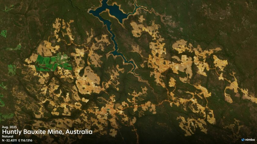
Seamless & cloud-free
A clean, globally consistent view of the Earth, ready to use.
Imagery + elevation
Satellite basemaps and global DEM, aligned and co-delivered.
Ready to integrate
Standard tile formats for simulators, operational platforms, and IFE systems.
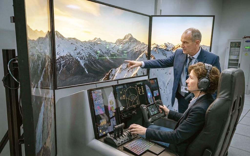
VISUAL QUALITY
Simulation-grade visual fidelity
In simulation and defense, the satellite layer is the environment. Pilots, planners, and analysts rely on the landscape to make critical decisions. But visible seams, abrupt color shifts, and cloud shadows instantly erode that trust.
Every application requires a coherent, natural-looking representation of the world:
- Pilot Training: Credible, artifact-free out-the-window views.
- Strategic Planning: Accurate terrain reading to support operational decisions.
- Situational Awareness: Seamless displays across wide-scale operational environments.
IMAGERY + ELEVATION
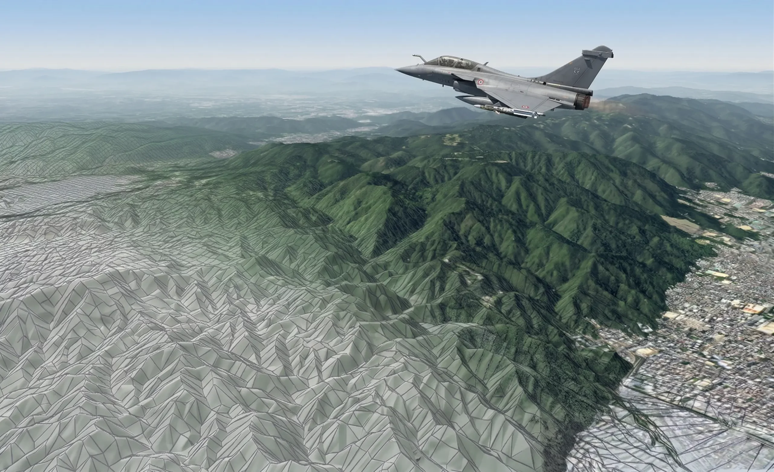
From 2D Imagery to 3D Environments
A flat map only becomes a realistic environment when draped over accurate elevation data.
Sourcing aligned imagery and DEMs from the same provider ensures rendering engines ingest them seamlessly. This streamlines and simplifies your integration pipeline for:
- Terrain Generation: High-fidelity 3D environments in professional simulators.
- Moving Maps: Real-time situational awareness for advanced airborne platforms.
- Strategic Planning: Accurate spatial analysis to support complex, high-precision operations.
FRESHNESS & GROUND TRUTH
Synchronize your simulation with reality
Static visual databases diverge from the real world over time. Traditional manual updates take months, creating a critical gap between simulation and reality.
Regularly refreshed imagery eliminates this gap for:
- Operational Simulation: Align environments with real-world locations.
- Civil Aviation: Match scenery to expanded airports.
- Strategic Planning: Inform critical decisions with current ground truth.
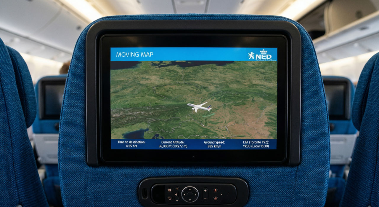
In-Flight Entertainment
Interactive moving maps are a central part of the modern in-flight experience. Nimbo provides stunning, cloud-free satellite basemaps and 3D terrain designed and optimized for IFE systems. Our globally consistent and natural-color imagery transforms standard flight tracking into a highly visual journey, ensuring seamless performance for:
- Real-time flight tracking: Beautiful, high-fidelity satellite basemaps for an enhanced passenger experience.
- Seamless IFE integration: High-performance visual clarity across all interactive moving map displays.

Flight-Ready Terrain and Imagery
Skip the processing pipeline. Get cloud-free 10m/2.5m basemaps perfectly aligned with global elevation data. Our monthly, color-harmonized tiles are ready for instant ingestion into simulation environments and operational platforms.