Satellite Imagery Pricing: Rethinking how we buy Earth Observation data
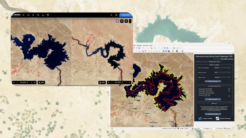
For years, acquiring satellite imagery has relied on highly customised quotes and complex licensing structures. While this model made sense for bespoke defence and enterprise contracts, modern workflows require a different approach. The Earth Observation industry is ready to evolve from individualised procurement to predictable SaaS infrastructure. Here is how Nimbo is turning satellite data into a standardised, plug-and-play resource.