NIMBO Monthly Basemaps
Save big time on satellite analysis
Speed up your workflow
with Nimbo’s GIS-ready satellite maps.
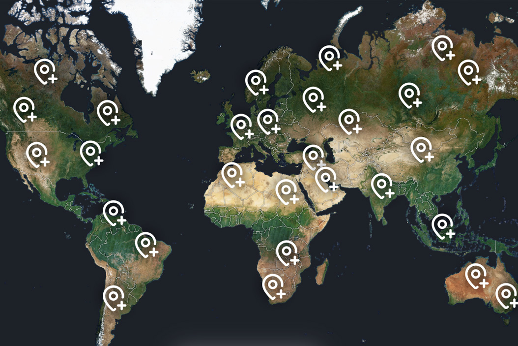
Worldwide, cloud-free, updated every month.


50
Hours saved per user per month
150 ms
Average map response time
260
Layers available from 2019
300
TB of Sentinel data pre-processed for you every month
Hours become minutes, at every step
Let your GIS workflow take off
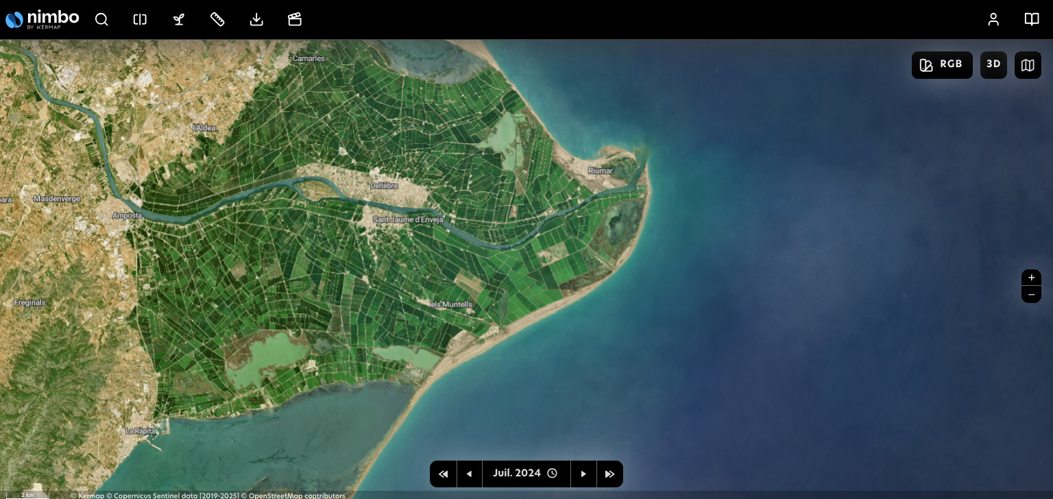
Nimbo’s basemaps are designed for smooth integration into GIS softwares. Forget clumsy EO platforms, tedious area selection, expert image preparation : just pick your month and let our TMS/WMTS serve you the whole world, without clouds.
Updated every month, worldwide
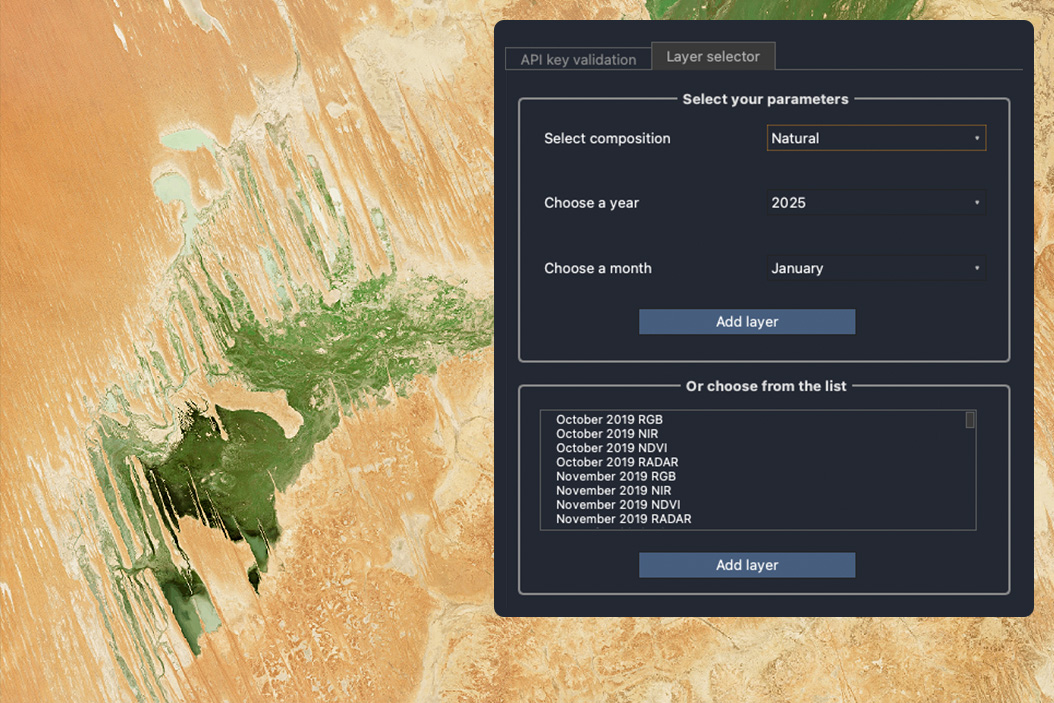
Nimbo leverages Sentinel’s passive and active sensors to produce synthetic satellite views in five color layers
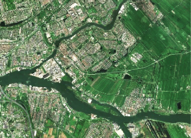
Natural colors
RGB (Red Green Blue)
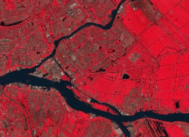
Near Infrared
NIR
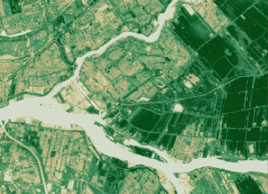
Vegetation health index
NDVI
Save 33%
Discovery
0 € /month
- 2.5 & 10m resolution
- Full timeline
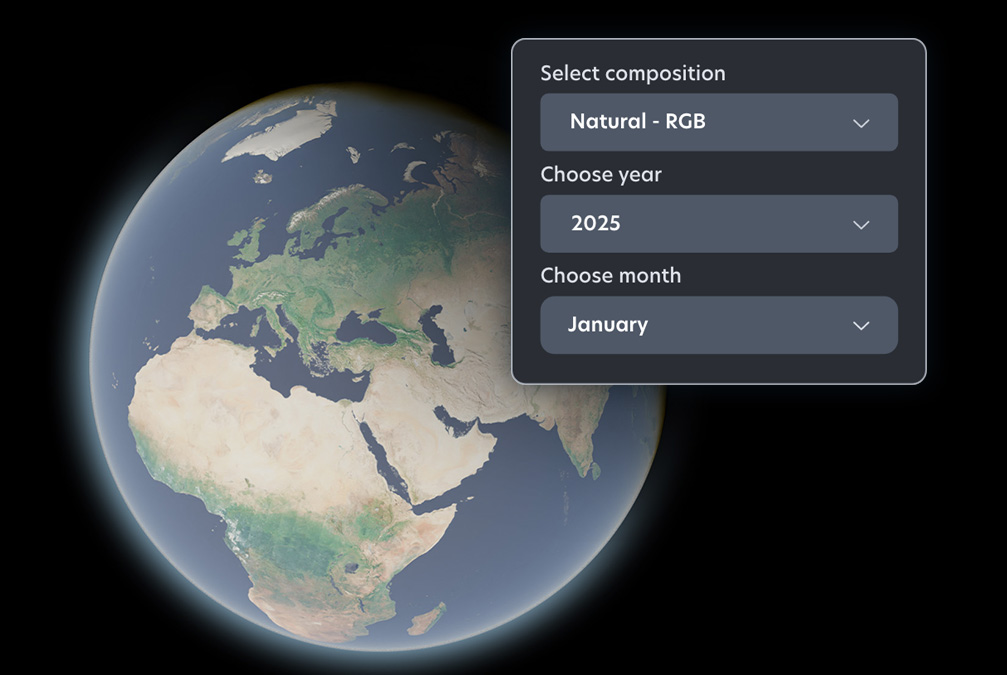
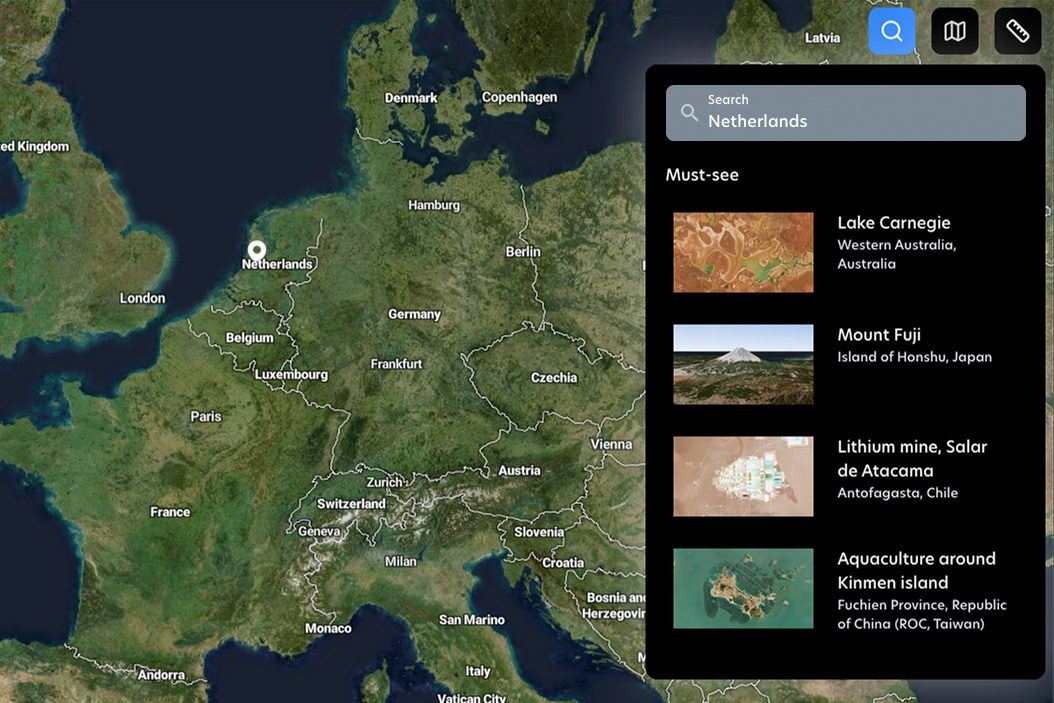
- Earth online platform (2D/3D)
- TMS / WMS access for GIS
2 test layers (watermarked)
- Natural colors HD
- Natural colors
Pro
From 20 € /month
- 10m resolution
- Full timeline
- Earth online platform (2D/3D)
- TMS / WMS access for GIS
3 layers (no watermark)
- Natural colors
- Infrared
- Vegetation index (NDVI)
Pro HD
From 45 € /month
- 2.5 & 10m resolution
- Full timeline
- Earth online platform (2D/3D)
- TMS / WMS access for GIS
4 layers (no watermark)
- Natural colors HD
- Natural colors
- Infrared
- Vegetation index (NDVI)
Enterprise
Your project
Everything in Pro HD, plus :
- Basemap integration
- Data download
- NDVI monitoring (API)
Advanced services
- Terrain : DEM - Hillshade - Terrarium
- Tracability layer
- Vegetation index (LAI)
- Radar
Nimbo Monthly Basemaps specs
| Description | Monthly composites based on Sentinel-2 MultiSpectral Instrument (MSI), using 13 bands: 4 visible bands, 6 Near-Infrared bands, and 3 Short-Wave Infrared bands |
| Temporal Resolution | Monthly |
| Number of used bands | RGB (Red Green Blue) : 3 / Infrared : 3 / NDVI : 2 / (Enterprise plan > LAI : 8) |
| Additional bands | – |
| Spatial Resolution | 10 m |
| Bits depth | 8 bits |
| Measurement | Bottom Of Atmosphere (BOA) |
| Coordinate Reference System | UTM/WGS84 |
| Coverage | World |
| Access | TMS and WMTS protocols |
FAQ on Nimbo Monthly Basemaps
What are Nimbo Monthly Basemaps?
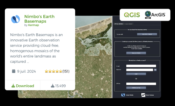
Nimbo Monthly Basemaps are satellite map layers providing a clear view of Earth, without clouds, updated every month. Our world maps are updated every month and designed for fast integration and reliable visualization in tools like QGIS, ArcGIS, and other geospatial apps via TMS/WMTS. Learn more on Nimbo's online basemaps production.
Which basemaps should I choose?
Criteria | Monthly Basemaps | Monthly HD Basemaps | Annual HD Basemaps |
|---|---|---|---|
Highlighted resolution | 10m | 2.5 m (AI-enhanced) | 2.5 m (AI-enhanced) |
Update frequency | Monthly | Monthly | Yearly |
Coverage | Global Land (85°N to 85°S) | Global Land (85°N to 85°S) | Global |
Access / delivery | Streaming via TMS, WMTS or WMS | Streaming via TMS, WMTS or WMS | Streaming (TMS/WMTS/WMS) or Download (COG/GeoTIFF/MBTiles) |
Latest version availability | Around the 15th of the following month | Around the 15th of the following month | End of June for the current year |
Metadata | Traceability: pixel-level acquisition date | Traceability: pixel-level acquisition date Confidence: pixel-level super‑resolution reliability/uncertainty | Confidence: pixel-level super‑resolution reliability/uncertainty |
Available archive | Europe+MENA (Oct 2019→Feb 2022); USA+Europe+MENA (Mar 2022→Jan 2023); Global (Feb 2023→present) | Since April 2025 | Since June 2026 |
Use cases | Environmental & forest monitoring Agricultural and land-use analytics Large-scale screening and change detection | Forestry and natural resource operations Mining and infrastructure monitoring Renewable energy planning | Simulation and defence applications Broadcast media and visual storytelling GIS, mapping and digital twins |
What makes Nimbo basemaps different from other satellite basemaps?
Unlike traditional basemaps that may be weeks or years old, Nimbo’s monthly updates ensure you’re working with recent satellite views. They’re also processed to be cloud-free and harmonized for consistent use across time series analysis. See how Nimbo compares to Google Earth.
How often are Nimbo basemaps updated?
Nimbo basemaps are updated every month, providing a recent and reliable view of the Earth throughout the year. This regular refresh cycle helps ensure that changes on the ground are reflected quickly, while maintaining visual consistency across updates. Monthly updates strike a balance between freshness, stability, and global coverage for production platforms.
Nimbo's historical basemap stack goes back to 2019, meaning you can analyze multi-year trends and assess evolutions over several years.
What's the imagery resolution ?
Standard Nimbo basemaps provide up to 10 m per pixel imagery, suitable for regional and landscape-level analysis. For higher detail, the Nimbo Pro HD tier offers enhanced imagery at 2.5 m resolution using AI super-resolution techniques.
Which data layers are available?
Each monthly basemap includes multiple layers:
RGB (natural colors), Infrared, NDVI (vegetation health), Leaf Area Index, Radar reflectance, and a Digital Elevation Model (DEM).
Do I need a subscription to use monthly basemaps?
You can start with a free tier (Discovery) to try the basemaps. Paid plans (Pro, Pro HD, Enterprise) unlock more layers, higher resolution, and additional features like expanded geocredits and commercial use options.
Can I use these basemaps in my GIS software?
Yes. The basemaps are served via TMS/WMTS protocols, making them compatible with most GIS software including QGIS and ArcGIS, and accessible through dedicated plugins or direct service URLs. Learn more on Nimbo's GIS formats.
Is Nimbo compatible with QGIS ?
Yes. Nimbo data can be added to QGIS via TMS/WMTS protocols, or directly via the dedicated QGIS plugin. More on Nimbo data in QGIS.
What are geocredits and how do they work ?
Geocredits are a usage measure for how much you interact with the basemap streams (e.g., navigation, zoom, downloads). Every time you request a map tile (via TMS, WMS or WMTS), you spend one GeoCredit. More on the mapping tile system.
That’s it : 1 tile = 1 GeoCredit. Each subscription tier comes with a monthly geocredit allowance. Learn more on Nimbo Geocredits.